
 Home/Blog
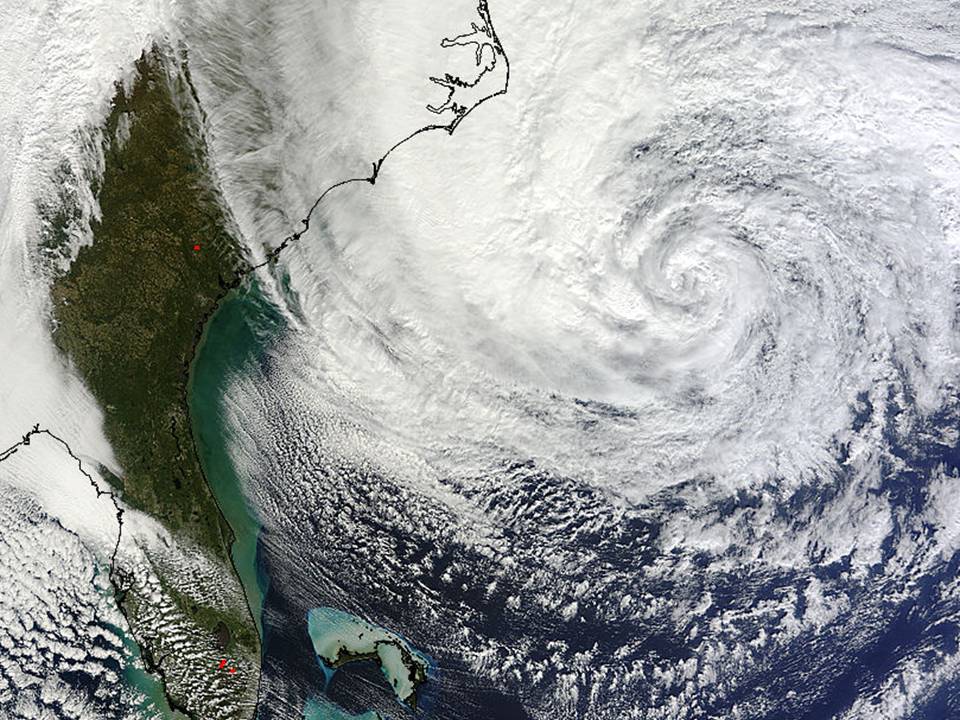
As Hurricane Sandy completes it’s transformation into a strong nor’easter (“Frankenstorm Sandy“), I think it will likely break a record for the lowest barometric pressure for a “winter” cyclone in the Northeast U.S. There will also be widespread heavy rain, which almost always leads to some local record rainfall amounts depending upon just where rain bands happen to sit for an extended period of time.
But I predict it won’t break any records for wind speeds or snowfall. A few locations might see record storm surges, but again those have a lot to do with the chance superposition of wind direction, long fetch, and lunar tides.
So what has made Sandy so exceptional?
It is basically the “perfect storm” scenario of the chance timing of a tropical cyclone merging with an extra-tropical winter-type storm. Without Hurricane Sandy off the coast, the strong trough over the eastern U.S. (caused by cold Canadian air plunging southward) would have still led to a nor’easter type storm forming somewhere along the east coast of the U.S. But since Hurricane Sandy just happens to be in the right place at the right time to merge with that cyclone, we are getting a “superstorm”.
This merger of systems makes the whole cyclone larger in geographical extent than it normally would be. And this is what will make the surface pressures so low at the center of the storm.
This type of event is certainly not unprecedented, and something like it happens just about every year…just not over the Northeast U.S. These events are somewhat more common in the northwest Pacific Ocean or farther north in the Atlantic Ocean. We did an internal study of these events about ten years ago (never published) using QuikScat, AMSU, and buoy data, and it is amazing just how strong some of these hybrid winter storms can get.
So, while Frankenstorm Sandy will indeed have great local significance, it is premature to claim it has any global significance, such as a response to global warming. We would need to see more of these events occurring over many years, on a quasi-global basis…and even then the increase would need to be shown to be unrelated to natural climate modes of variability, such as the Pacific Decadal Oscillation or Arctic Oscillation.


