
 Home/Blog
Over the next seven days you can expect many news stories coming out of Europe concerning an unusually cold and snowy weather pattern setting up that will hit southern and eastern Europe the hardest.
Up to two feet of snow will occur in some areas with balmy Portugal being the only European country to escape snowfall.
As the following total snowfall forecast map through January 1 shows, even southern Italy, Greece, and far northern Africa can expect snow (graphic courtesy of Weatherbell.com, click to enlarge):
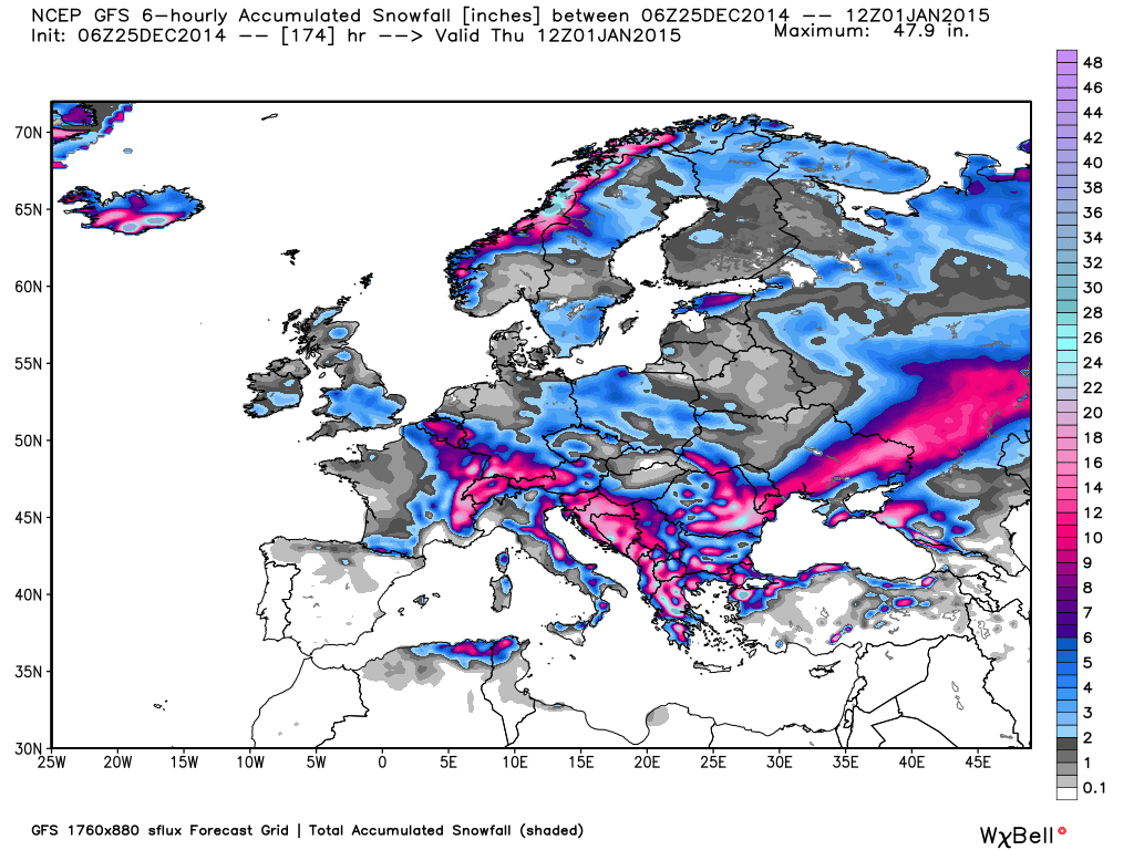
Total snowfall forecast from Dec. 25 to Jan. 1, from the GFS model (courtesy of Weatherbell.com).
As is usually the case, the cold air is flowing from northwestern Russia westward and southward into Europe, north of persistent broad low pressure that will form over the Mediterranean Sea. The seven-day average temperature departures from normal for Dec. 28 to Jan. 4 will run 10 to 20 deg. F below normal over much of Europe:
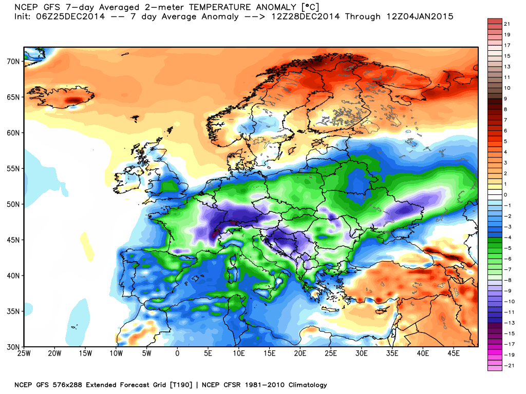
Seven day average temperature departures from normal (deg. C) for the period 28 Dec. to Jan. 4 (GFS model graphic courtesy of Weatherbell.com).
This cold weather will not be welcome by most, as energy prices haven risen significantly across much of Europe, partly due to reliance on expensive renewable energy sources.


