
 Home/Blog
Anyone who has traveled on airplanes a lot has probably seen the glory (or halo) phenomenon when looking at the shadow of the airplane on the cloud deck below. A rainbow-colored circle can sometimes been seen.
But the same kind of phenomenon can sometimes be seen in color satellite imagery….but it requires the right conditions. The following image was taken yesterday, south of California (click image for full size).
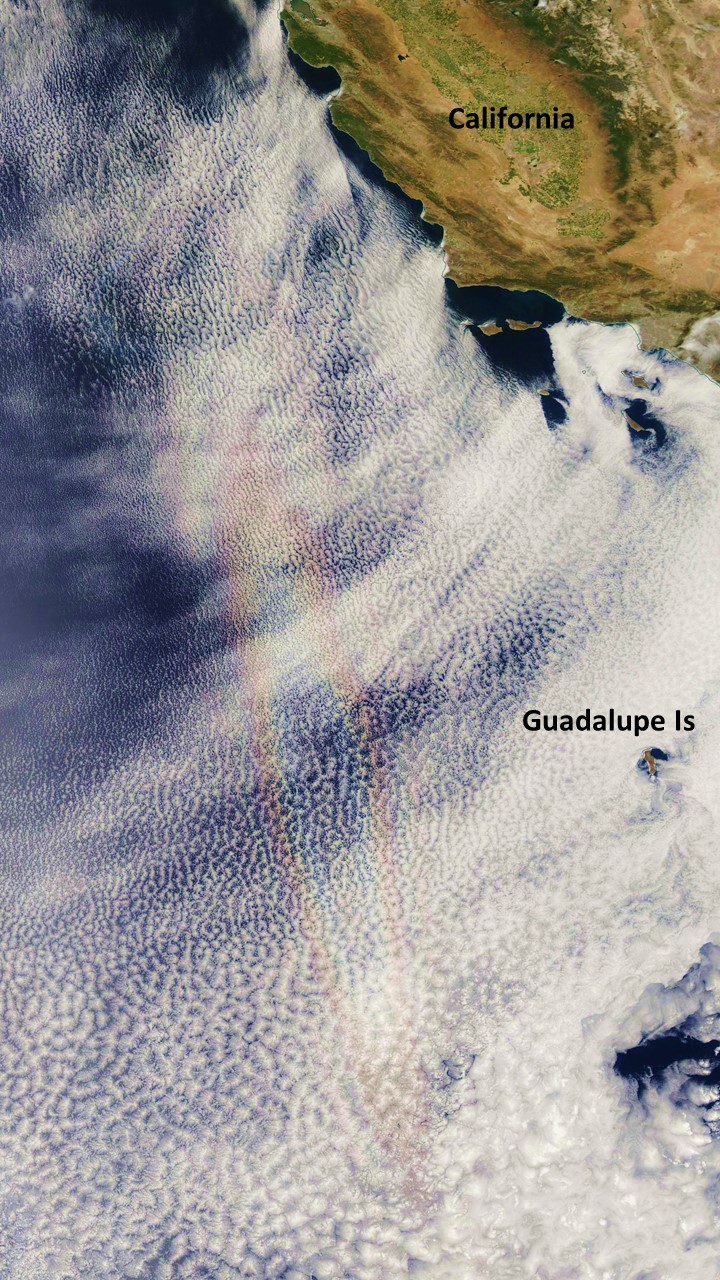
Optical glory phenomenon seen by the NASA MODIS imager on 16 June 2015.
Due to the latitude of Mexico’s Guadalupe Island, and the persistent marine stratocumulus layer there, I’ve found this to be the best place to see the event. The reason the glory is elongated is that the satellite imager doesn’t actually take a 2-D photo, but scans directly under the satellite path below, basically building up an image with a bunch of narrow scans. Repeated image slices through the circular glory builds up an elongated glory.
Pretty cool.


