
 Home/Blog
The wildfires north of San Francisco are far from contained today, with over 90 sq. miles torched, 9,000 firefighters involved battling the blazes, and 13,000 people ordered evacuated from their homes.
Yesterday afternoon this NASA satellite color image showed the locations of satellite-observed hotspots (red dots) and smoke spreading westward out over the Pacific Ocean (click for full-size):
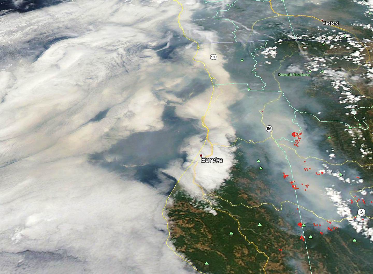
NASA color imagery from the Aqua satellite showing widespread wildfires over Northern California (remapped into Google Earth).


