
 Home/Blog
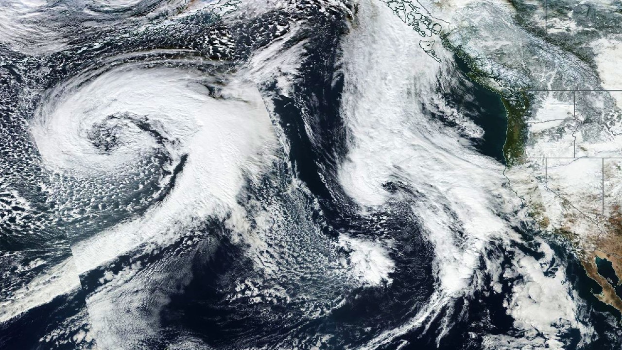
Suomi satellite color image of Pacific storms lining up on January 2, 2016.
With the Sierra Nevada snowpack above normal in this El Nino-fueled winter, we now enter what is usually the peak stormy season for the West Coast when El Nino gets in full swing.
As suggested in the above satellite image, a series of Pacific storms will bring more rain and abundant mountain snows, with totals ranging up to 10 feet over the next 10 days, and widespread amounts over 4 feet (GFS model graphic courtesy of Weatherbell.com):
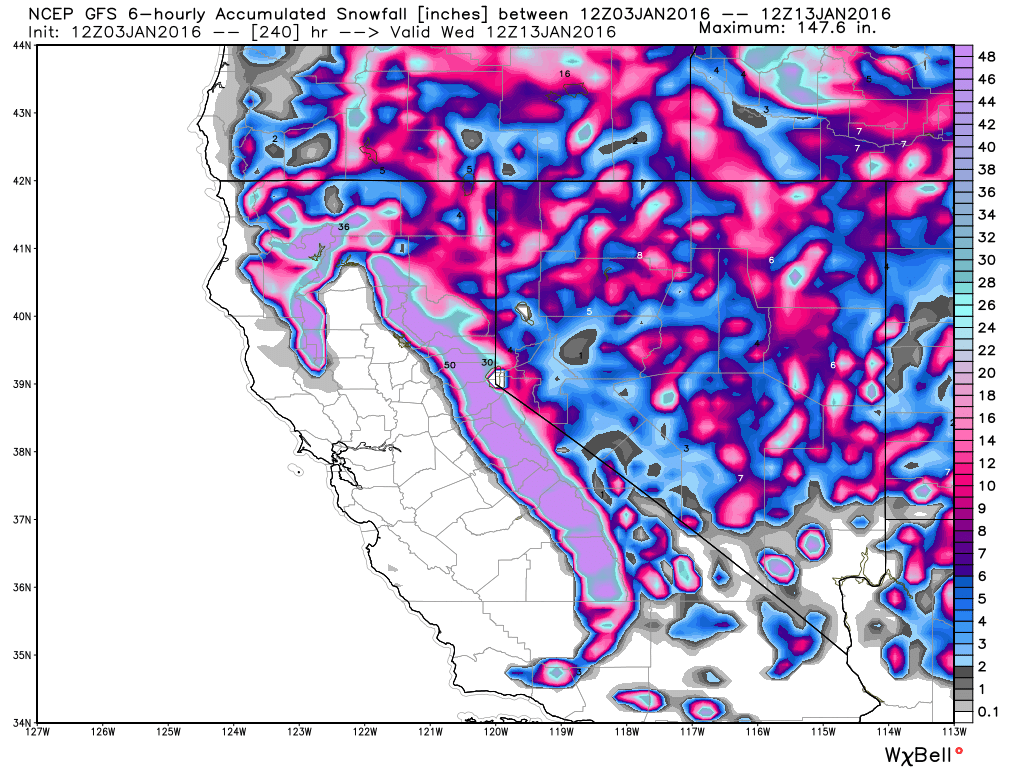
GFS model forecast of total snowfall in the next 10 days, ending January 13, 2016.
While the California drought is far from over, the coming storms are a good sign that the snowpack might be headed for a more comfortable 150% of normal come April 1, which is what will be required to bring reservoirs close to a normal level after the snow melts.
The snows will not be restricted to California, as almost all mountain ranges in the West will also be receiving substantial new accumulations over the same period.


