
 Home/Blog
With more rain and snow on the way, the supposed “unending drought” that the New York Times reported on last year has, in a matter of weeks, ended — at least in Northern California.
Yesterday’s color satellite imagery from NASA shows the dramatic changes which have occurred since the same date three years ago:
– Widespread and deep snowpack
– Greening vegetation
– Rivers overflowing their banks
– Strong river discharge into the Pacific Ocean
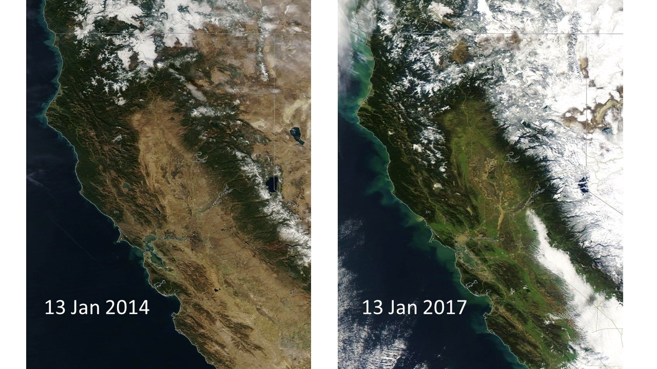
NASA Aqua MODIS color satellite imagery of N. California separated by exactly three years, showing dramatic snowpack increase, vegetation greening, and river discharge into the Pacific Ocean.
Here’s a zoomed version of the NASA Terra MODIS image yesterday covering the San Francisco Bay area northeastward toward Sacramento:
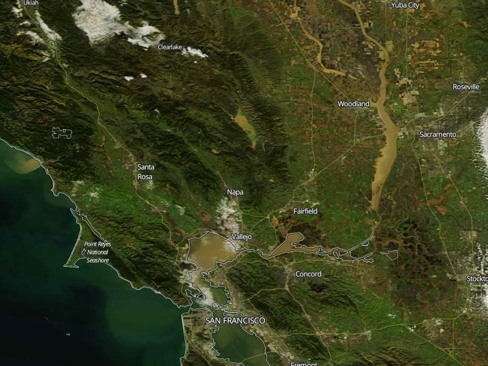
NASA Terra MODIS zoomed image on 13 January 2017 covering San Francisco to Sacramento.
The latest GFS model forecast for the next 10 days predicts another 2 to 10 inches of rain, depending on location, with several more feet of snow at higher elevations.


Kituchat.com cng cụ tạo k tự khoảng trống, k tự đặc biệt đẹp v đầy đủ nhất hiện nay. Gip người dng c thể dễ dng v nhanh chng tạo cho mnh cc k tự đặc biệt chất kitudacbiet
fancy text generator – cool symbol free
chua benh lau o dau, kham benh lau o dau, xet nghiem benh lau o dau.