
 Home/Blog
With the climatological peak in hurricane activity only 3 weeks away, the Atlantic has been fairly quiet so far, despite seasonal forecasts of a more active than normal season.
But recent forecast model runs have been consistently predicting that a low pressure wave in the tropical eastern Atlantic will become Tropical Storm Gaston in the next 5 days or so. Then, it looks like it could intensify into Major Hurricane Gaston, with 110 kt sustained winds by Sunday evening, August 28, which would make Gaston a strong Category 3 hurricane (graphic courtesy of Weatherbell.com):
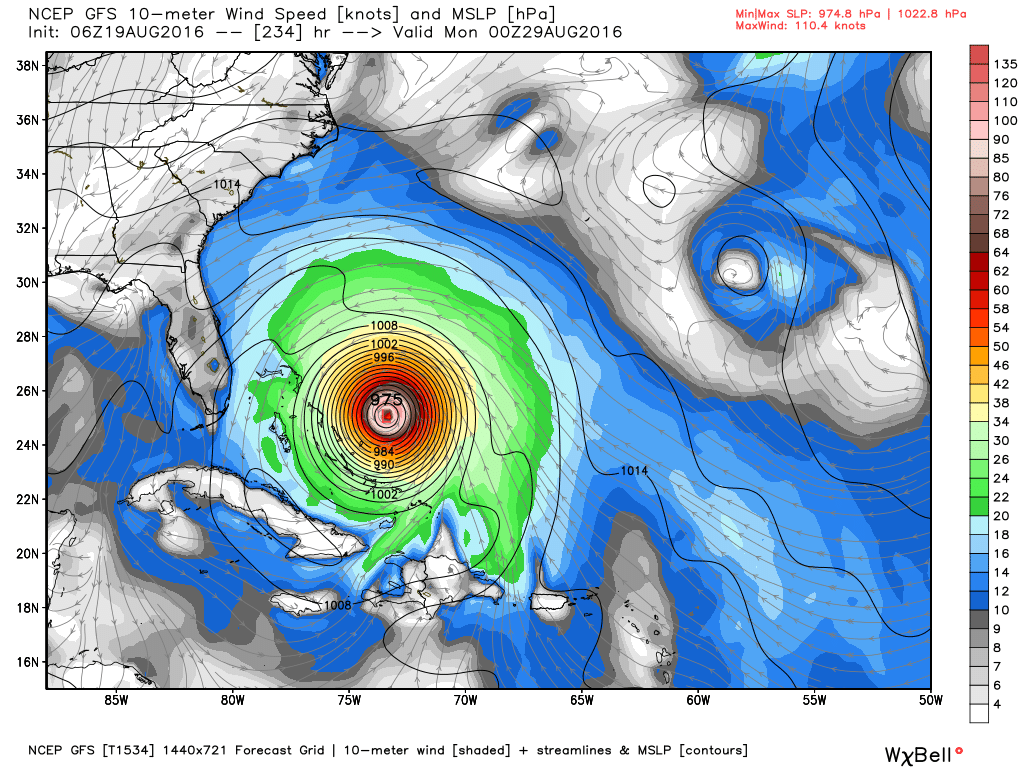
GFS model forecast of seal level pressure and wind speeds for Sunday evening, 28 August 2016. Graphic courtesy of Weatherbell.com.
Of course this is very prelimnary, being almost 10 days out, and the system is currently not even a tropical depression yet. The predicted path of (potential) Gaston is especially uncertain. Interests along the Atlantic and Gulf coasts should monitor this system in the coming days.


