Archive for November, 2014

Frostweed Time Lapse, Take 2

Friday, November 28th, 2014

This is my second attempt at capturing a “frost flower” growing out of the frostweed plant (White Crownbeard).

I set up my camera and tripod at 1 a.m., the temperature was 29 deg., and the “flowers” had already started growing. I collected 5.5 hours of photos (1 per minute) which I made into this time lapse video, which is 1800 times faster than real time.

Click on the full-screen icon for the best viewing…the video is high-definition.

CA Drought Relief this Weekend

Wednesday, November 26th, 2014

Storm system approaching N. California on Nov. 25, 2014.

Storm system approaching California on Nov. 25, 2014.


A Pacific storm system continues its trek to California where it promises to bring 3 to 6 inches of much needed rain. The storm will stall and weaken just off-shore this weekend as another system from the Gulf of Alaska drops down and causes re-intensification. The result will be 3-5 days of on-and-off rains from Friday through Tuesday, with isolated areas possibly getting 9 inches or more (NCEP/WCP graphic courtesy of Weatherbell.com, click for full size):

6-day total rainfall forecast (Nov. 26 - Dec. 2) from the NCEP Weather Prediction Center.

6-day total rainfall forecast (Nov. 26 – Dec. 2) from the NCEP Weather Prediction Center.

Heavy rains are needed by reservoirs, currently at record-low levels, since light rains simply soak into the parched ground. While the storm will also bring 1-2 feet of welcome snowfall to the Sierra Nevada, the expected heavy rains are the most beneficial for filling reservoirs.

Major Storm to Bring Drought Relief to California

Monday, November 24th, 2014

Tuesday Morning (11/25) Update: It now looks like portions of Northern California could get as much as 5 to 10 inches of rainfall, with the Central Valley getting 1-2 inches or more. So I’m calling this a “major” storm now.

Late this week a vigorous Pacific storm system will track down the California coastline, bringing much needed rain to almost the entire state, and snow in the Sierra Nevada. The “Pineapple Express” system formed north of Hawaii, and will be joined up by another system sliding southward from the Gulf of Alaska.

It looks like at least half the state should get 1 inch 2 inches or more of rain, with 2+ feet of snow in the Sierra. Here’s the latest 8-day precipitation forecast from the GFS model (graphic from Weatherbell.com):

GFS model forecast total precipitation by Tuesday, Dec. 2, 2014 (12Z 11/25 model run time).

GFS model forecast total precipitation by Tuesday, Dec. 2, 2014 (12Z 11/25 model run time).

The rain will start in the northwest corner of the state on Friday (Nov. 28) as the Pacific low pressure approaches, and gradually spread south and east across the state through the weekend.

Hopefully this won’t just be a one-off event, but I suspect California will be glad to take whatever it can get. Here’s the latest weekly drought map, showing just how severe the drought has been over California.

A Snowy Thanksgiving for NYC?

Sunday, November 23rd, 2014

turkey-in-snow-smallIt is increasingly looking like New York City could have only its second white Thanksgiving in 75 years, the last being 25 years ago in 1989.

In fact, most of the major metropolitan areas along the I-95 corridor need to be watching the weather this week, especially if you have travel plans on Wednesday, which is when most of the snow is forecast to fall. It is still early, but the forecast models have been pretty consistent over the last couple days in forecasting this event.

After a new blast of cold air sweeps across the eastern U.S. early this week, an upper atmospheric disturbance just entering the Pacific Northwest today looks like it will phase up with a weak surface low pressure center in the southern Gulf of Mexico. The low will strengthen as it rapidly tracks up the coast, just offshore, with snow extending from portions of Georgia and the Carolinas northeastward to cover most coastal areas.

Several weather forecast model runs in a row now have been in general agreement, with the latest forecast snow amounts for the major metro areas being generally 4-6 inches or more (graphics from Weatherbell.com, updated from early morning Tuesday run):

GFS model forecast total snow accumulation by Thursday morning, Nov. 27, 2014 (early morning Tuesday model run)

GFS model forecast total snow accumulation by Thursday morning, Nov. 27, 2014 (early morning Tuesday model run)

Are Personal Drones Dangerous Enough to be Banned?

Friday, November 21st, 2014

The DJI Phantom 2 Vision Plus quadcopter with gimbal-stabilized HD video camera.

The DJI Phantom 2 Vision Plus quadcopter with gimbal-stabilized HD video camera.

For months I’ve been wrestling with the urge to get a quadcopter drone for photography, and I would be interested in readers’ opinions on the subject of safety.

When people hear “drone” they often think of the large, unmanned aerial vehicles (UAVs) used to fire missiles at terrorists. But there is a new class of very small drones that are inexpensive and are usually used for aerial photography. Currently the most popular is the DJI Phantom 2 Vision Plus.

These are legal to operate below 400 ft altitude, but not in the vicinity of airports. The National Park Service has temporarily banned them due to reports of excessive noise and disturbing wildlife (they sound like a swarm of bees when flying).

There are also a few reports of these things hitting people. Here in Alabama, someone operating one at the Alabama football stadium last weekend accidentally hit a pedestrian (who wasn’t injured).

The machines aren’t toys. You have to learn how to fly them (which is pretty easy). They typically weigh several pounds, which isn’t much…unless you smack someone in the head with it at 40 mph.

You don’t just turn them on and fly them. You have to go through a checklist of procedures, to make sure the drone isn’t going to get confused when you send it on its merry way. Sometimes the drones can experience “flyaways”, usually the result of the operator not making sure the drone had sufficient GPS signal to monitor its location and speed.

Now, it would be tempting to say we should just ban all drones, even for pleasure use.

But do we ban bicycles when their use (even for pleasure) leads to many hundreds of injuries, and even a few deaths, among pedestrians each year?

It’s only a matter of time before someone is accidentally killed by one of these things, and there might well be a knee-jerk reaction to ban them altogether.

I don’t have a strong opinion one way or the other. I’m curious what you think.

Is Global Warming Causing More Snowstorms? No, It Isn’t

Friday, November 21st, 2014

Lancaster, NY received 6 feet of snow in the recent storm. (AP - Gary Weipert)

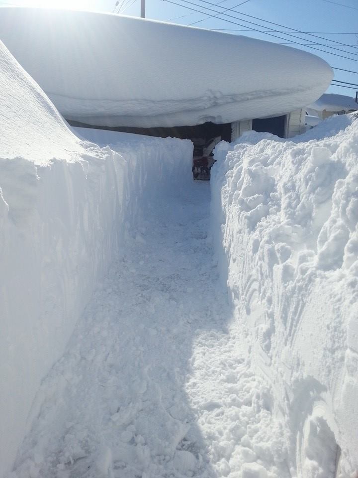
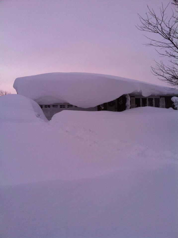
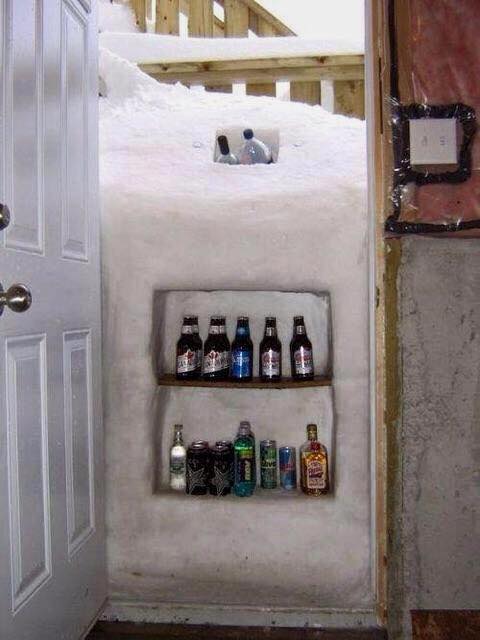
Lancaster, NY received 6 feet of snow in the recent storm. (AP – Gary Weipert)

It has become axiomatic (and fashionable) that any change we see in nature is caused by global warming climate change.

Global warming was going to make snow a thing of the past. Until someone looked out the window and decided global warming causes more snow.

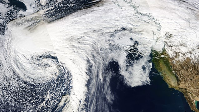
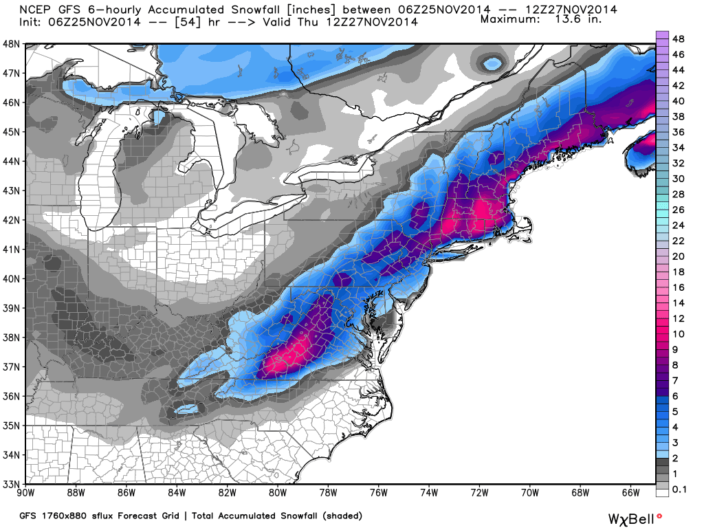
The epic Buffalo, NY storm this week was still in progress when that opportunistic organization Climate Central announced that more lake effect snow could be expected with global warming.

SIGHHH.

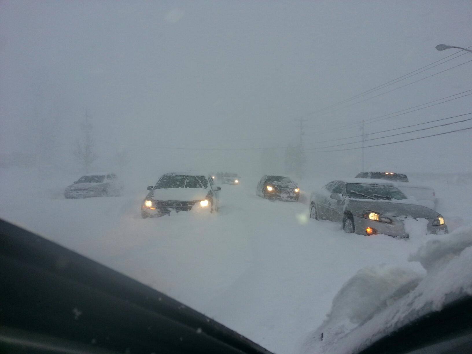
Except that the Great Lakes were unusually cold this year, after near record cold last winter. Then, an even more unusual cold blast of air that started over eastern Siberia made it’s way to the U.S. and the cooler lake waters were not enough to depress the lake effect snow machine: over 6 feet of snow has fallen south and east of downtown Buffalo this week.

So, in what universe does a cold winter, a cool summer, cold lake water, and an unusually cold fall air mass result from global warming?

Not in our universe.

The computerized climate models that provide the basis for climate change proclamations produce less snow with warming. Yes, a warmer world has more water vapor in the atmosphere to feed snowstorms, but you need atmospheric circulations driven by large-scale temperature contrasts to form low pressure systems. And since the equator-to-pole temperature contrast has decreased in recent decades, we should be seeing less storminess.

Yet, there are a few researchers (e.g. Jennifer Francis at Rutgers) who claim the reduced equator-to-pole temperature contrast is being accompanied by more storminess. But this does not make physical sense from a basic atmospheric energetics standpoint. You cannot have more storminess from a reduced temperature gradient. It’s like getting something from nothing, like a perpetual motion machine. The consensus on the idea is that it is wrong, even from pro-global warming researchers.

There has been no substantial trend in Northern Hemisphere wintertime snow cover since records began in the late 1960s, but spring snowcover has decreased, due to spring tending to arrive earlier in a slightly warmer world.

What DOES affect Northern Hemisphere weather patterns are known climate cycles: the Pacific Decadal Oscillation (PDO), and the North Atlantic Oscillation (NAO), which can change our average winter weather for about 30 years…before changing again. In recent years, we have entered the negative phase of the PDO, which could mean winters more typical of the 1960s and 1970s for the next 20+ years. But no one really knows.

On shorter time scales, El Nino and La Nina, as well as the Arctic Oscillation, can strongly impact individual winters.

But when people immediately point to ‘global warming’ anytime something unusual happens, it is (in my opinion) just intellectual laziness — or money-driven advocacy.

It’s just weather, folks.

That Epic, Fickle, Shovel-off-to-Buffalo Snow: An All-Time U.S. Record?

Thursday, November 20th, 2014

(NEW: Is Global Warming Causing More Snowstorms?)

I have a special place in my heart for lake effect snow. Living in Sault, Michigan as a teenager is what got me interested in weather and started me down my career path.

But it’s hard to compete with what Buffalo, New York gets for lake effect snow. Over six feet of snow fell in some areas on the south side of town in the last 48 hours, most of it in a 24 hour period.

Just getting to your garage can be a problem (Steve Frost).

Just getting to your garage can be a problem (Steve Frost).

The all-time U.S. record for a 24 hour snowfall is 76 inches in Silver Lake, Colorado way back in 1921, and it is possible this was exceeded yesterday. We will have to wait and see what NOAA decides. (There’s a rumor going around Facebook that the record was beat, but I think that was just a misunderstanding of a Facebook post by NWS/Buffalo personnel.)

The reason why Buffalo gets pounded so bad is the shape of Lake Erie…long and narrow, so a cold wind blowing down its length generates a single, intense snow band. You are either in it or out of it. Driving down the road, you can be in sunshine one minute, and in white-out conditions the next. This pair of pictures taken at the same time only 5 miles apart in Buffalo during the storm illustrates the fickle nature of lake effect storms.

Lake effect snow bands - either you are in or out (Shannon Clare).

Lake effect snow bands – either you are in or out (Shannon Clare).

Imagine your boss says he needs you at work…after all, there’s almost no snow downtown at the office! Yet, your house looks like this.

Buried house in a Buffalo suburb (Jackie Parker).

Buried house in a Buffalo suburb (Jackie Parker).

You open your front door, and are greeted with this:

West Seneca, NY (Jessica Marie).

West Seneca, NY (Jessica Marie).

A second round of lake effect snow started again last night — and again with thunder! Thunder in lake effect snow is quite unusual, indicating very strong cloud updrafts from the very cold air mass sitting over the “warm” lake water.

Do I need to remind everyone it’s only mid-November?

So, when winter fall gives you too much snow, you just make the best of it:

(Anonymous).

(Anonymous).

Here’s an interesting Weather.com summary of what it considers the 6 snowiest cities in the U.S.

Guess what? Buffalo (despite the early teaser) isn’t one of them.

NEW: Is Global Warming Causing More Snowstorms?

Frost Flower Growing Time Lapse

Wednesday, November 19th, 2014

When I left the house for work yesterday morning, I saw what looked like tissues on the ground in the woods behind our house. They were something I’ve never witnessed before — “frost flowers”. They only form from a relatively few kinds of weeds in the fall or early winter when there is enough moisture in the soil (we just had two inches of rain) and it gets cold quickly (the temperature dipped to 21 deg. F overnight). Water “wicks up” through the stem (which appears to split) and turns to ice, which slowly grows into delicate ribbons.

It this case it looks like they formed on the “frost weed” (White Crownbeard), and there were about a dozen of them of different shapes, generally several inches across.

I set up my camera and tripod at 8:30 a.m. and collected 6.5 hours of photos which I made into this time lapse video, which is 900 times faster than real time. The ice flower can be seen to still be slowly growing, until it warmed enough for the flower to fall apart. I cut the video off before I noticed new ice starting to grow out the stem again.

Click on the full-screen icon for the best viewing…the video is high-definition.

Buffalo Area Reeling from Snowstorm

Tuesday, November 18th, 2014

Update 10:20 a.m. EST Wed. Nov. 19: Local NWS has stated isolated areas on the south side of Buffalo could have received as much as 70 inches of snow. It is very difficult to measure snow accumulations in these conditions. Some vehicles were stranded for many hours, and the National Guard was called in to help. Four Six area deaths have been attributed to the storm. After a brief break today, a new round of lake effect snow is expected in the same area tomorrow. Here’s time lapse of the snow squalls coming in off Lake Erie into South Buffalo on Tuesday (iPhone 6 time lapse video by Alfonzo Cutaia):

As predicted, the lee shores of Lake Erie and Lake Ontario are being clobbered by lake effect snow right now.

Here’s a photo just posted to Facebook by someone stuck in traffic, obviously sitting under the main snow band coming off Lake Erie:

Cars stuck in a heavy snow squall on Tuesday morning, Nov. 18, 2014, presumably on the south side of Buffalo, NY.

Cars stuck in a heavy snow squall on Tuesday morning, Nov. 18, 2014, presumably on the south side of Buffalo, NY (photo: Jeremiah William).

Already, 2 to 3 feet of snow are being reported, and the storm is expected to continue throughout the day. Local totals to 5 feet or more are possible…it all depends on how long the snow bands stay anchored over one spot.

Here’s the advice just posted by NWS Buffalo on their Facebook page:

“Travel within the lake effect band is IMPOSSIBLE, if you attempt to travel through the band you WILL GET STUCK. If you live in the south towns STAY PUT! If you live in the north towns DO NOT try traveling to the south towns.

I’m sure we will be hearing similar stories from the Watertown, NY area (to the lee of Lake Ontario) as the day progresses.

Here is today’s NASA MODIS image (Terra satellite) of the region, mostly covered in lake-generated snow shower clouds, with the heavy-snow areas near Buffalo and Watertown marked with red circles (click for full-size):
MODIS-lake-effect-E-Lakes-11-18-2014-GE

Note that all of the Great Lakes are producing lake effect snow today to the east of the lakes.

A Year in the Life of CO2

Tuesday, November 18th, 2014

This is pretty cool. A NASA model simulation of how CO2 (and carbon monoxide) is transported after it is emitted. They also have hi-res movies for other regions, but here’s one for the globe:

If you go to their website you can download the hi-res versions. The files are huge, but on a large monitor the detail in them is astonishing… as mesmerizing as watching a fire in the fireplace.

This kind of simulation could be done for any atmospheric tracer, not just carbon dioxide. The color range represents only 20 ppm in CO2 concentration (plus or minus 2.5% of the average concentration). Try not to get freaked out by all of this “pollution”…it is, after all, necessary for life on Earth. Some of the sources in the simulation are also vegetation over land….but the urban and industrial sources are more dramatic.

(h/t Cal Beisner)