A White Thanksgiving for New York City?

November 22nd, 2013 by Roy W. Spencer, Ph. D.

[UPDATED with 12Z Nov. 22 model plots, now putting the storm just offshore.]

I’ve been watching the setup for what could turn into a white Thanksgiving for much of the Northeast..and maybe a travel nightmare for the day before Thanksgiving.

From what I can tell, the last white Thanksgiving in NYC was about a quarter century ago (in 1989), and before that was a half-century prior to ’89. Maybe my friend Joe Bastardi will correct me.

Predicted cold air outbreaks for the Northeast and mid-Atlantic in the coming days, combined with a low pressure system moving across the northern Gulf of Mexico, are consistently combining in the GFS model to produce an early-season nor’easter, with significant snow from the mid-Atlantic up through New England.

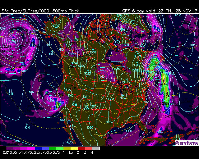
From last night’s this-morning’s GFS run, here’s the sea level pressure and 12-hr precip plots for Thanksgiving eve and morning:
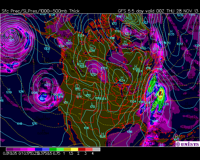
gfs_pres_5e_11-28-2013-00Z
gfs_pres_6d_11-28-2013-12Z

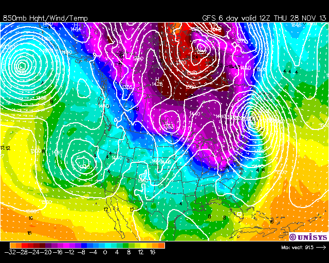
And here are the corresponding 850 mb forecast plots, which also show the cold air mass associated with the system:
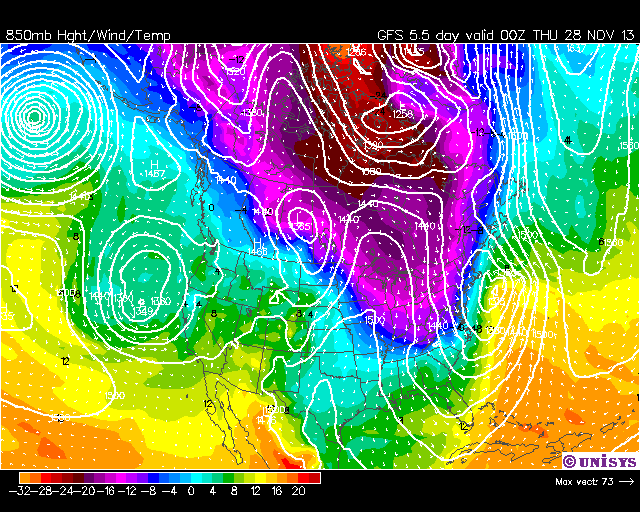
gfs_850_5e_11-28-2013-00Z
gfs_850_6d_11-28-2013-12Z

Now, for nor’easters to form and impact the East Coast, timing of the cold air arrival versus the low pressure approach from the southwest is everything.

If cold air arrives a little early, the system remains off the East Coast, with only windy and colder weather for the East. If the cold air is late, the storm moves inland with rain for the East, and snow for the Ohio Valley and eastern Great Lakes. Given this is all a week away, things could change significantly by then.

But those planning on travel to the East Coast for Thanksgiving should keep an eye on this situation in the coming days.

Oh, and if NYC does get hit with significant snow for Thanksgiving….let me be the first to blame global warming for it. 😉


15 Responses to “A White Thanksgiving for New York City?”

Toggle Trackbacks

  1. Mac says:

    🙂

  2. Hot Potato says:

    I’m Dreaming of a White Thanksgiving….just like the ones I used to know….in my best Bing Crosby rendition.

    There’s some truth in that statement. In 1971 we lived in Dallas, Pennsylvania which is a small town up the mountain from Wilkes Barre in the valley. We received approximately two feet of snow that year on Thanksgiving. Actually, it started the day before and continued on into Thanksgiving. I’ll never forget it. The stuff dreams are made of. It was glorious to wake up to all that snow…and some of the drifts were seven to eight feet high. We played all day in it. And then feasted….and feasted….and feasted. Ah, the memories. And, of course, that evening, Burl Ives narrating Rudolph The Red-Nosed Reindeer came on. It was Nirvana. Fleeting, yes, but that’s what makes moments such as that so special and memorable.

    http://www.easternuswx.com/bb/index.php?/topic/65817-thanksgiving-1971-snowstorm/

    • Roy Spencer says:

      a trip down memory lane. 🙂

      • Lisa Symeon says:

        I stumbled across this post while trying to confirm that my memories of the 1971 Thanksgiving Eve/Day snow storm….and watching Rudolph that Wednesday night were accurate. The Dallas, PA caught my eye immediately as I’m from (and still live in) Wilkes-Barre. Thank you!

  3. Jim Cripwell says:

    On a similar theme. The ice wine harvest is in full swing in British Columbia.

  4. RW says:

    Oh boy, I have to travel on Wednesday from NJ to PA.

  5. ren says:

    Why is currently in the Arctic increased temperature? That’s the answer.
    http://www.cpc.ncep.noaa.gov/products/stratosphere/strat_a_f/gif_files/gfs_t50_nh_f00.gif

  6. pochas says:

    A suggestion for weatherstreet: Instead of printing black outlines for political boundaries, print them in a contrasting color (based on the color of the immediately adjacent background). It’s nearly impossible to judge location when political boundaries are invisible because of a same-color background. A computer should be able to select an appropriate color for political boundaries on-the-fly pixel-by-pixel and make your graphics much more readable (and garner many extra views). Possibly, simply invert the graphic and print the political boundaries in the inverted color. Or maybe just invert the background pixel.

  7. ren says:

    Why does America face a very harsh winter? The reason is in the stratosphere. A strong lock is still visible at a height of 30 km and above. You can also see northern jet stream direction.
    http://www.cpc.ncep.noaa.gov/products/stratosphere/strat_a_f/gif_files/gfs_z10_nh_f00.gif

  8. Bret Durazo says:

    . this website caters towards the rap genre. My company helps the facebook accounts of rap artists.If you is interested in promoting clients, let us know on our site! Thanks.

  9. news stories says:

    Great work, a couple of extremely logical tips! I value you penning this blog post and the rest of your web-site is terrific!

  10. I truly enjoy looking through on this internet site, it holds superb posts.

Leave a Reply