Here’s the NASA MODIS image of 140 mph Typhoon Vongfong from several hours ago, which I have displayed in Google Earth, as it approaches Okinawa (click for full size version):
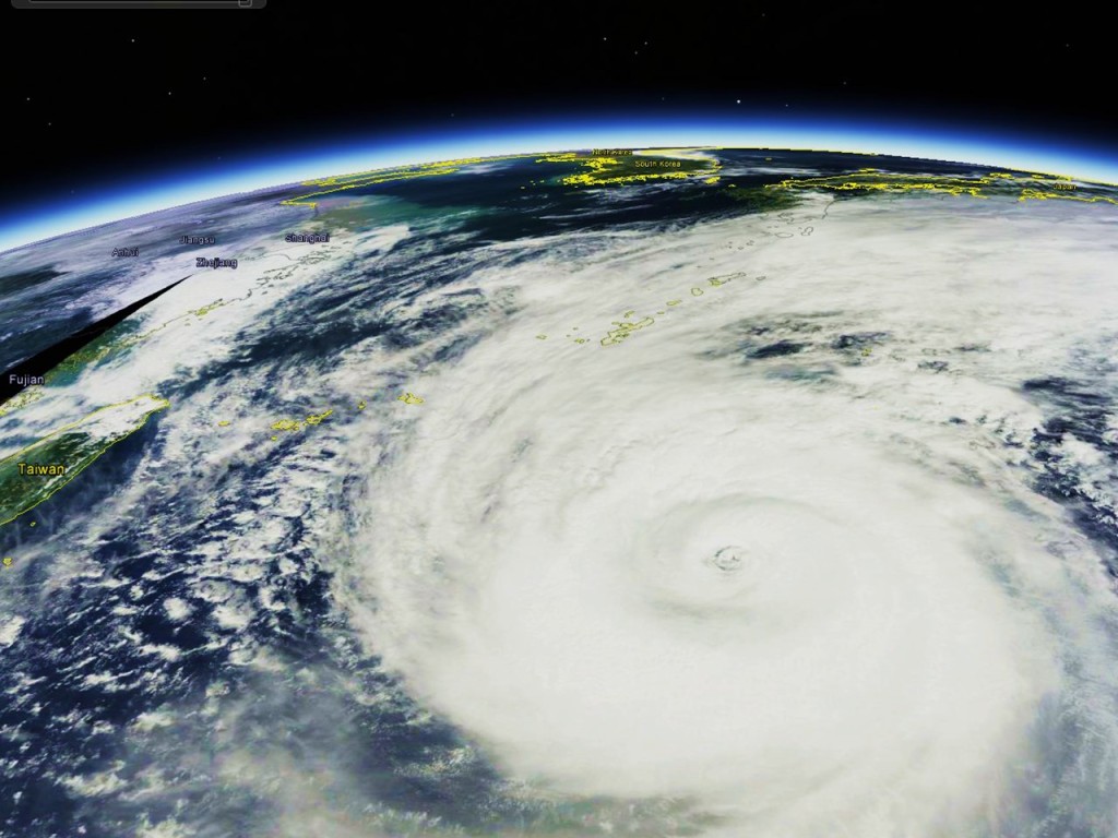
Typhoon Vongfong, at 140 mph intensity, as seen by the NASA MODIS instrument midday October 10, 2014
As seen in the latest forecast track, Vongfong is expected to make a direct hit on Okinawa, then progress up through the main islands of southern Japan.
Funny how the NuSchool image has the wind speed for that storm at just under 120 Km/H, yes Kilometers per hour, that seems a bit less than the 140 Mph quoted.
I have found NuSchool to be quite accurate regards winds around the UK.
can’t explain that…140 mph is the official estimate from 1.5 hours ago.
120 Kilometers per Hour is only about 75 MPH. It has to be higher wind speeds than that!
Ouch… Japan has had some bad luck. I wish them the best.
How much ocean heat energy will be dissipated at lower latitudes that otherwise would have been carried to northern Pacific waters and released there ?
Interesting question. Wikipedia has a table giving size comparisons:
http://en.wikipedia.org/wiki/Orders_of_magnitude_(energy)
It says 5e19 joule/dy for an average hurricane (in producing rain which is 400 times greater than the wind energy). This is compares to 6.4e19 joule/yr electrical energy produced by the world in 2008. And 50e19 joule/yr total energy consumption for the world in 2010.
No idea how decipher how much stays on earth (and where) and how much gets radiated to space.
“This dangerous storm has already recorded a brutal history. Vongfong, as a typhoon, brought flooding rainfall and damaging wind to the northern Mariana Islands on last Sunday, local time. Wind gusts over 89 kph (55 mph) and rainfall over 75 millimeters (3 inches) were common.”
Well who was correct then?
The overhyped 140Mph or NUSchool’s 120 Kph?