
 Home/Blog
Here’s the latest MODIS color image of Hurricane Gonzalo, currently a 110 mph (Category 2) storm (click image for full-size):
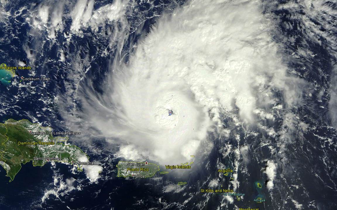
MODIS image of Hurricane Gonzalo mid-day Tuesday, October 14, 2014.
Gonzalo is forecast to strengthen, possibly to a Category 4 storm, before impacting Bermuda later in the week.


