Home/Blog
A cold airmass plunging out of Canada and a coastal low developing off the Carolinas by Saturday is the kind of weather event you expect in January — not November 1.
Snow is expected to fall over portions of 18 eastern states over the next 3 days, with the potential for earliest-ever snowfall in portions of the Carolinas by noon on Sunday (all forecast graphics courtesy of WeatherBell.com):
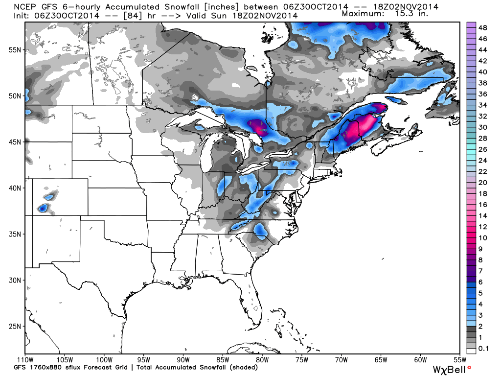
Total snowfall forecast by noon, Sunday, Nov. 2, 2014.
The surface air temperature departures from normal show this cold event pushing unusually far south for this time of year, with 20 deg. F below normal over much of the southeast, including all of Florida by Sunday morning:
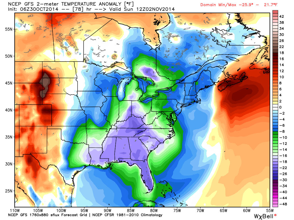
Surface temperature departures from normal forecast at sunrise, Sunday, Nov. 2, 2014.
The deep, cold airmass is what causes the “polar vortex”, which is the swirling of upper-air winds around the airmass. By noon on Saturday, the rapidly moving vortex will be centered near Charleston, SC:
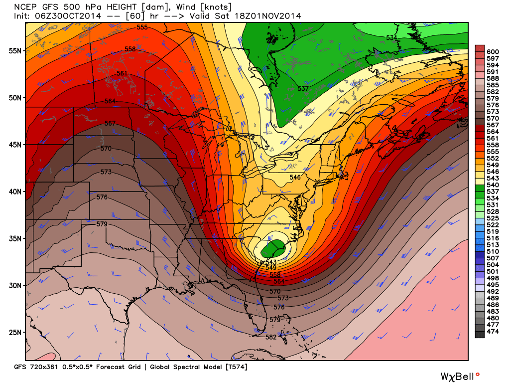
“Polar vortex” pattern at 18,000 ft altitude forecast to be centered near Charleston at noon, Saturday, Nov. 1, 2014.
Luckily, the deepening low pressure off the coast is expected to stay offshore, with northerly winds at Cape Hatteras around 50 mph Saturday night:
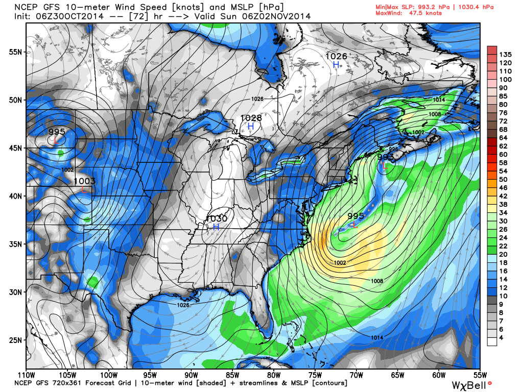
Surface pressure and wind patterns forecast for Saturday night.
By Sunday evening, the low is forecast to be centered over the Gulf of St. Lawrence, and by Tuesday morning total snow accumulations of 1 to 2 feet or more are expected over portions of Maine and the Canadian Maritimes.
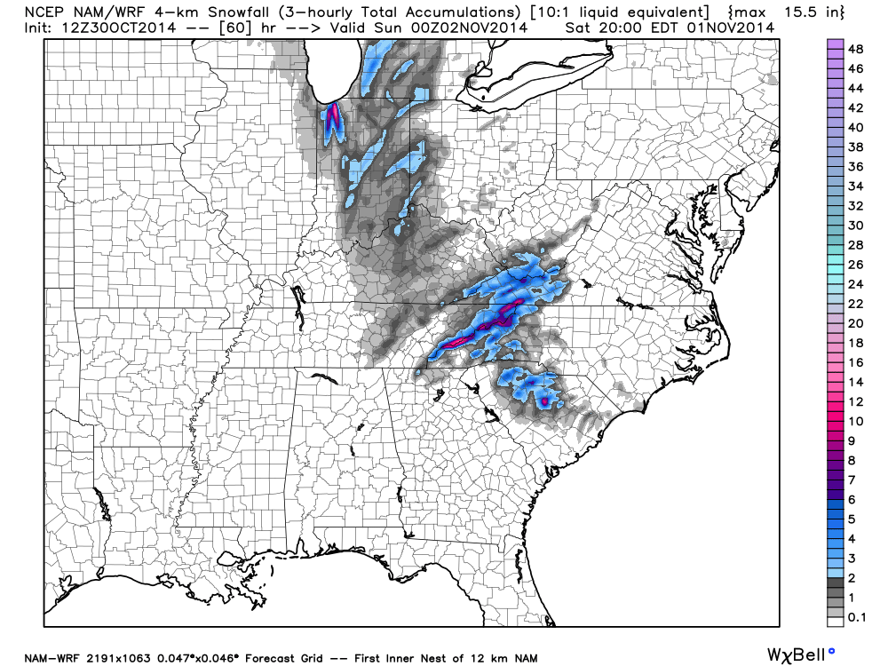
UPDATE (11:30 a.m. EDT Oct. 30):
Here’s the latest high-resolution model forecast of snowfall ending Saturday evening, showing flurries reaching scattered coastal areas of the Carolinas, and 6″-12″ snowfalls in the Smokey Mountains and to the lee of Lake Michigan in NW Indiana: