
 Home/Blog
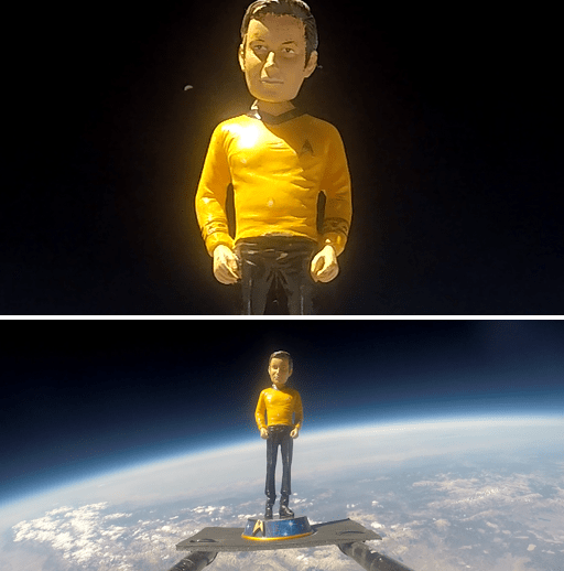
Capt. Kirk checks out the weather at 110,000 ft altitude.
Most meteorologists consider the stratosphere to be a pretty boring place: no warm fronts, cold fronts, low pressure systems, and (almost) no clouds.
But there are a couple of things that happen there which are pretty dramatic. Sudden stratospheric warming in the polar regions is one. Another, but lesser-known, type of event is sudden temperature changes in the tropical stratosphere.
For example, in the last week the tropical middle stratosphere, as measured by channel 14 of the AMSU instrument flying on NOAA-19, has cooled by over 3 deg. C (about 5 deg. F):
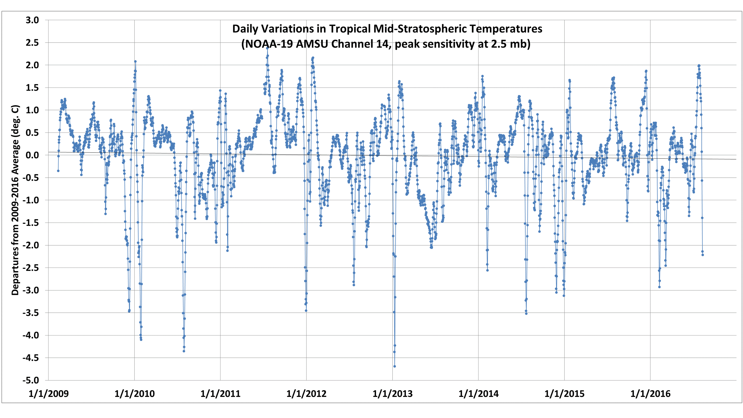
Daily departures from average in the temperature of the tropical (25N-25S) mid-stratosphere, through 10 August 2016.
The area covered is over 40% of the surface area of the Earth, so that’s a huge region.
The reason why such large temperature changes can occur in the stratosphere has to do with its vertical temperature structure, combined with dynamically-forced changes in the vertical circulation of air in the stratosphere.
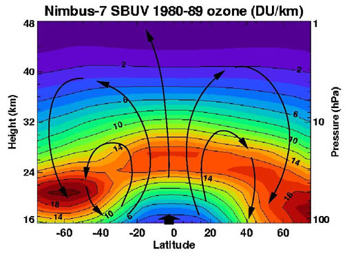
The unique vertical temperature structure in the stratosphere is due to ozone being created and heated by ultraviolet solar radiation. The ozone layer then shields the air below it from UV radiation, so the layer is maintained at a “warmer” temperature as it continues to absorb UV energy.
Since the temperature increases with height in the stratosphere, any forced ascent of the air will cause a large drop in temperature at any given pressure altitude (since dry air ascent at any altitude will result in a temperature drop of 9.8 deg. C per km). Similarly, forced descent will cause a large temperature rise.
Now, the global stratosphere experiences a slow vertical circulation called the Brewer-Dobson circulation, with slowly rising air in the tropical stratosphere and slow sinking of stratospheric air outside the tropics. This circulation explains why, even though most stratospheric ozone is created in the tropics where sunlight (per square meter) is most intense, the greatest concentrations of ozone are found outside the tropics, as it is exported out of the tropical stratosphere.
Weather activity generated in the troposphere is what is believed to force this circulation (e.g., see here). As Rossby waves and gravity waves in the lower atmosphere propagate upward and equatorward, changes in their activity can cause changes in the strength of the Brewer-Dobson circulation, leading to the large temperature changes seen in the time series plot, above.
So, stronger rising of the stratospheric air is what led to cooling in the last week, but that will be almost exactly matched by warming outside the tropics where air is sinking faster than normal. (Note that rising air in one location and altitude must be almost exactly matched by sinking air elsewhere at the same altitude, otherwise there would be huge pressure differences leading to tremendous winds which will act to remove the pressure difference…this is what happens in hurricanes to some extent, where atmospheric mass is removed from the center of the hurricane faster than it can be replaced by in-flowing winds.)
I suspect these stratospheric temperature variations changes have no measurable effect on weather in the tropical troposphere, even though they might change the tropical radiative energy budget by a fraction of a Watt per sq. meter.


