
 Home/Blog
We meteorologists have been watching what looks to be a major snowstorm shaping up for the eastern U.S. in the last couple days of 2017.
While it is still too early to tell just where the worst weather will be, it does look like frigid air coming down from Canada will be met by moist Gulf and Atlantic air, and a storm will develop in the central or southeast U.S. and track northeastward somewhere near the East Coast.
People all along the East Coast and New England should be watching forecasts for this system in the coming days, especially those who might be traveling to New York City for Times Square festivities. It is still not obvious whether the low pressure will track just inland or offshore, which has huge consequences for what kind of weather the I-95 corridor will experience.
Historically, the most accurate weather forecast model is the ECMWF. Here is the latest ECMWF snow depth forecast for ball-drop time on New Years Eve, courtesy of Weatherbell.com. It shows two feet of snow depth at midnight New Years Eve in New York City. Most of that snow is forecast to fall in the 24 hours prior to ball-drop time:
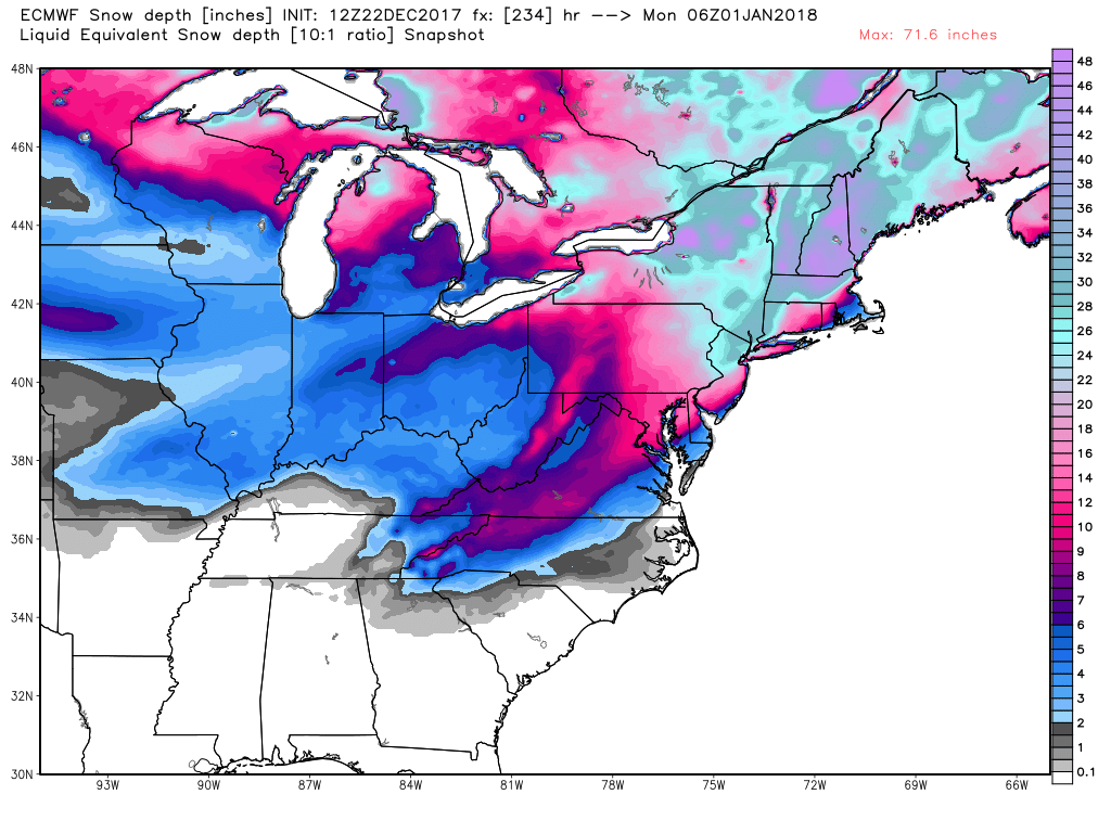
ECMWF 10-day snow depth forecast for midnight New Years Eve, December 31, 2017. This forecast WILL change as New Years Eve approaches.
Again, this forecast is 10 days away. But each forecast cycle in recent days has been predicting some sort of major winter event for the East in the last couple days of 2017.


