
 Home/Blog
With a winter of phenomenal heavy rains and snow (over 400 inches so far at some Sierra Nevada locations), Lake Oroville 65 miles north of Sacramento is literally entering uncharted territory in its 50 year history.
As the following chart shows, the reservoir is rapidly approaching its design capacity:
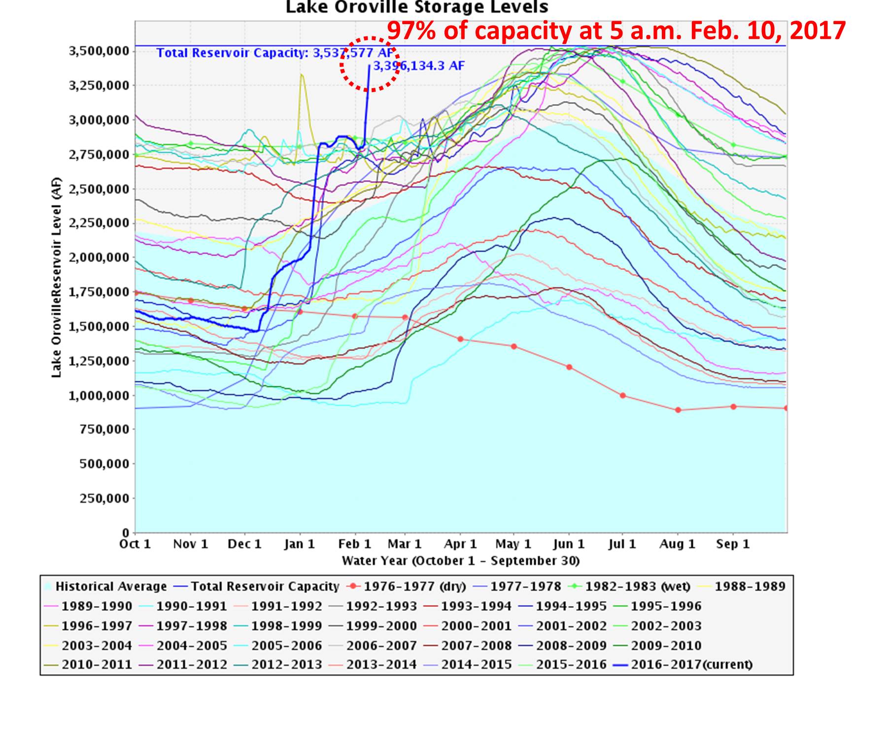
Lake Oroville water levels in different years, showing the current level is unprecedented for so early in the year, and rapidly approaching a 100% full state.
While the reservoir has been nearly full in some previous years, note that this occurred in early summer, after mountain snowmelt. We have not even reached snowmelt season yet, suggesting a continuing flooding problem in the coming months.
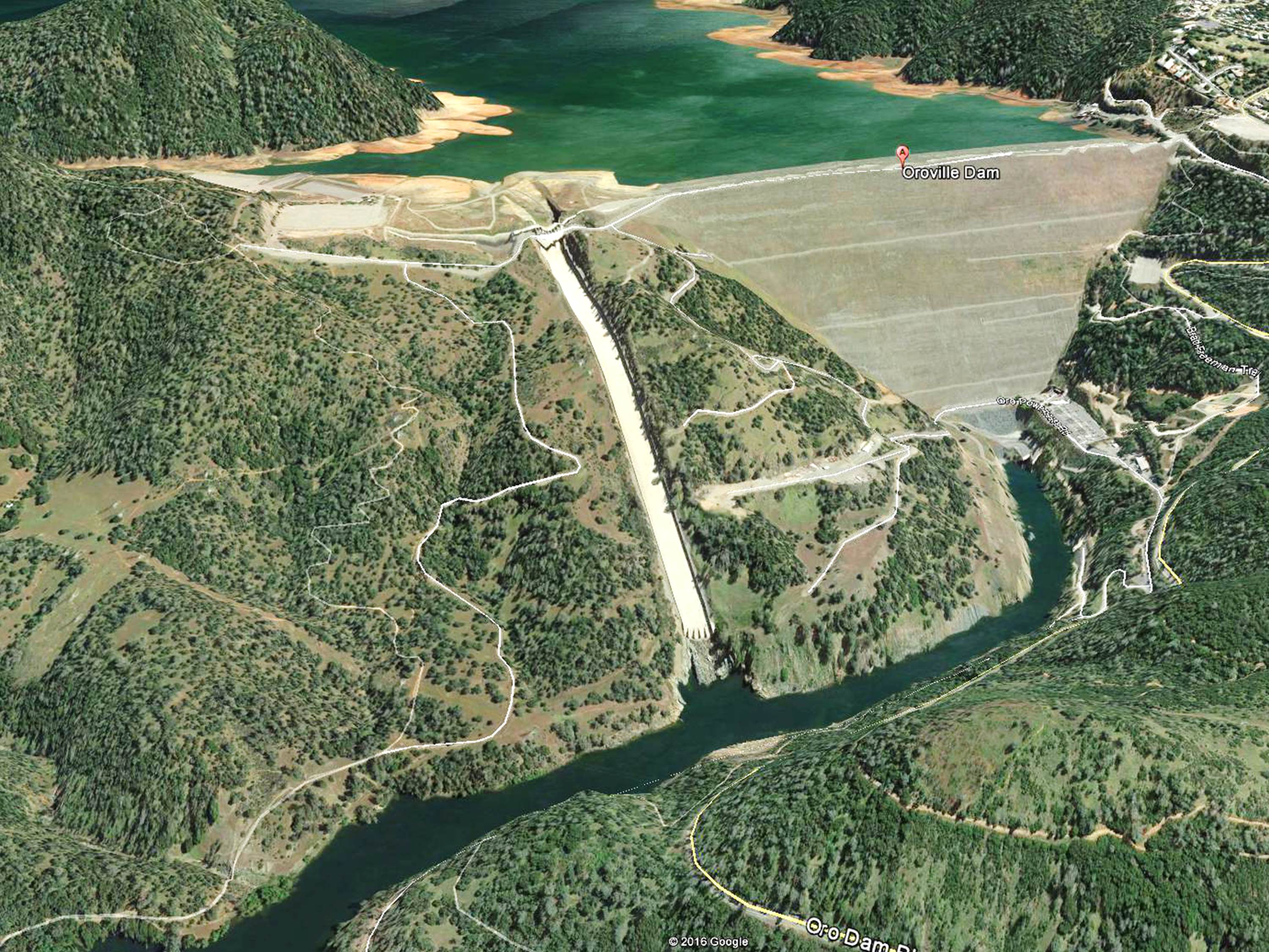
A few days ago engineers reassured us there was still 20% of the reservoir unfilled. Then yesterday morning it was 90% full. This morning at 5 a.m. it was 97% full, and at the rate it is filling, tonight or tomorrow it will likely overflow the emergency spillway for the first time ever. Here’s a Google Earth image of the dam in April 2015 (when the reservoir was only 50% full); the wooded area to the left of the narrow concrete spillway is where the water will likely overflow this weekend:
To make matters worse, the concrete spillway has been badly damaged due to partial failure, which will likely get only worse as it is used to avoid the emergency spillway for as long as possible:
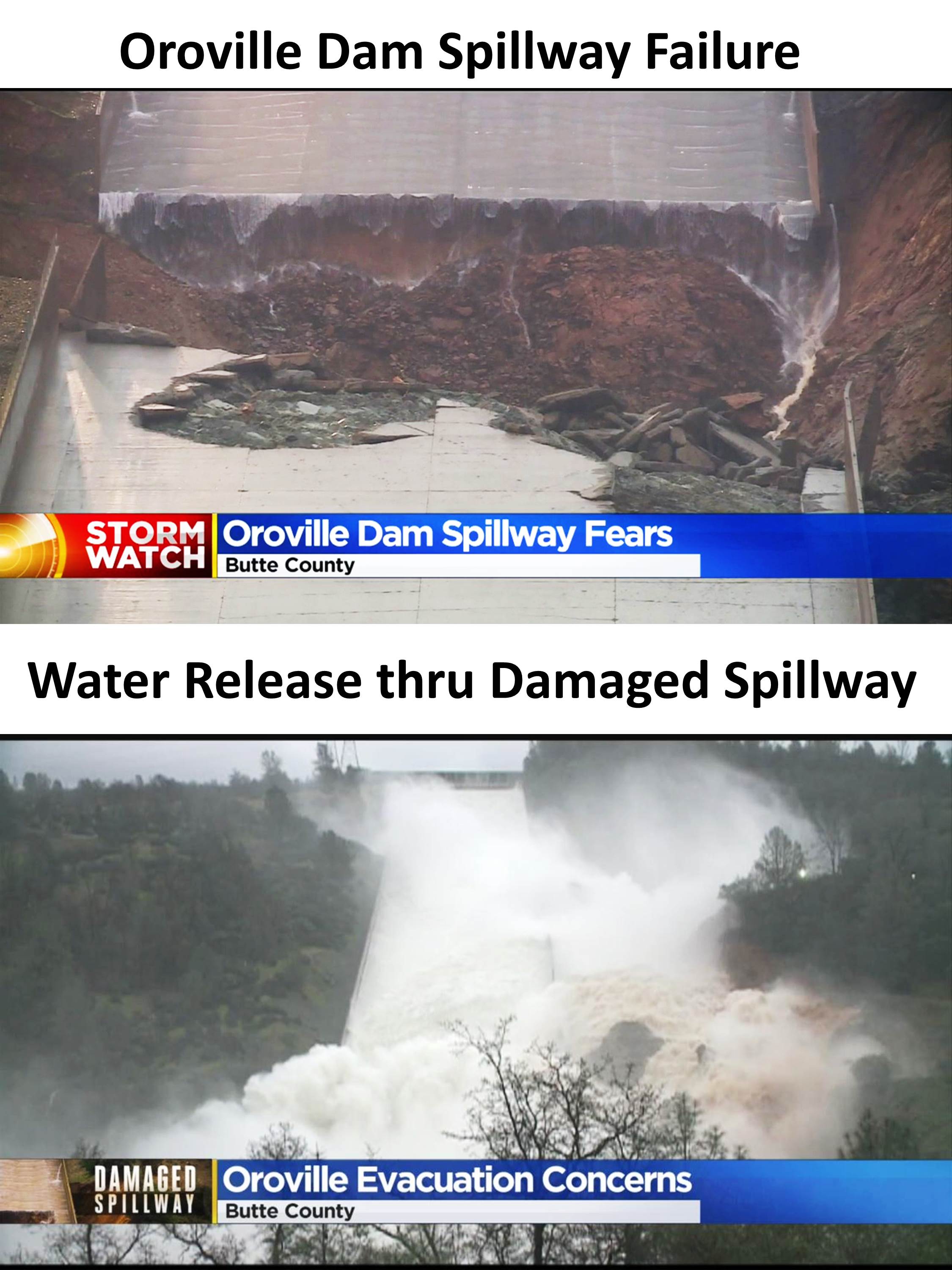
If water overflows down the emergency spillway, there will be a mess created in the Feather River due to soil, rock, and tree debris, threatening young salmon. The Feather River then flows into the Sacramento River farther downstream. Emergency officials are beginning to discuss evacuation preparations downstream.


