
 Home/Blog
Most days I check out the global MODIS imagery at the NASA Worldview website, and today I zoomed in on North Sentinel Island, in the Bay of Bengal. Looking through recent days, I noticed a plume of smoke starting on the afternoon of Saturday, March 8. Ever since then, there has been smoke evident on most of the days, through yesterday, and it seems to emanate from the north side of the island:
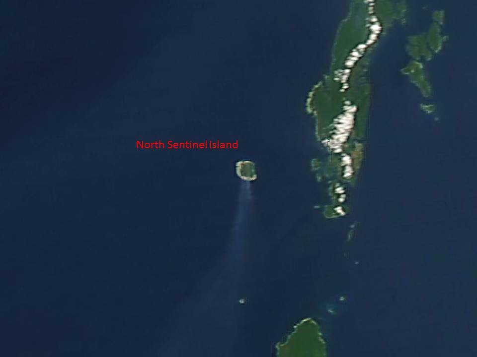
Smoke streaming southward from North Sentinel Island on 13 March, 2014.
The MODIS spatial resolution (250 m) is nowhere near good enough to observe something as small as an airplane, but it routinely sees smoke plumes. Now, it might well be that the natives on this (very primitive and hostile) island have burnings during this time of year. There are thought to be less than 100 inhabitants of the island, and they do not like visitors.
But, I looked through all of the days in March of last year (2013), and saw no obvious evidence of smoke. Nor was there smoke earlier this month before the plane disappeared.
I believe this is one of the many islands that is being targeted for investigation.
Interestingly, the island was raised 1 to 2 meters after the 2004 Indian Ocean earthquake, exposing many of the coral reefs surrounding the island.
I doubt that there is a connection to the missing flight, which would be a real shot in the dark. But it is a strange coincidence.
At a minimum, this is a plug for the NASA Worldview website, which I’ve been wanting to mention anyway.


