
 Home/Blog
Today marks the 25th anniversary of the tornado that tore through Huntsville, AL during rush hour, cutting the city in half, killing 21 people, injuring 463, and destroying 259 homes.
The EF-4 tornado formed just as the the storm entered the city from Redstone Arsenal and traveled right down Airport Road at 4:35 p.m. It rode up and over the hill at the east end of Airport Road, and intensified as it swept back down the hill, destroying Jones Valley Elementary School.
It then traveled through a residential area, destroying many homes. As it traveled up the mountain where I now live, debris rained down on the forest some of which is still visible today. Some of the trees in the woods behind our house permanently lean toward the northwest, a daily reminder of the event.
This photo taken after the tornado from the hill at the east end of Airport Road looking west can be compared to the same view that I photographed today, on the 25th anniversary (click for full size):
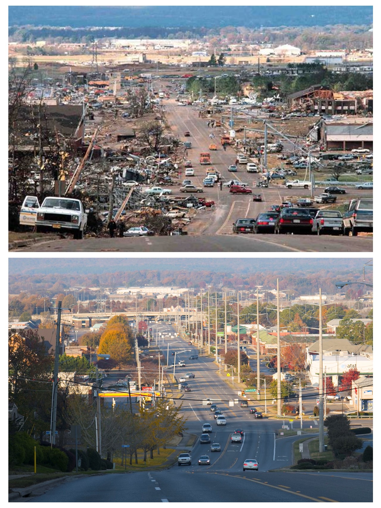
Airport Road seen exactly 25 years apart, showing the devastation from the Nov. 15, 1989 tornado and a quiet Saturday morning Nov. 15, 2014
The twister took out businesses, apartment buildings, churches, power poles, and many cars were mangled almost beyond recognition (many more photos and storm details are provided in this Al.com story).
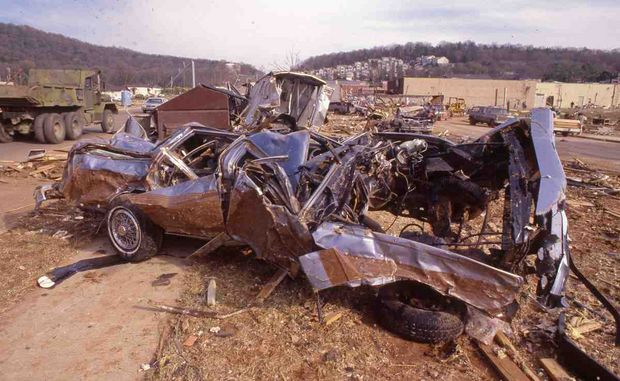
Photo credit: Bob Gathany, Al.com.
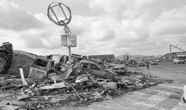
Photo credit: Bob Gathany, Al.com.
I worked at NASA/MSFC at the time and we were tracking the storm by a special satellite feed, since we didn’t have the many web-based resources back then. It was the especially dangerous situation of an isolated storm that looked like it might merge with an approaching squall line in advance of a strong cold front.
I went home early to watch from the vantage point of our home on the southwest edge of town, with an unobstructed view to the west.
Out of my 30+ years of storm watching, I can say it was the only time I was fearful of a storm.
The closer it got, the stronger the wind was flowing into the storm. I called my wife on the north side of town and told her to not let anyone leave the ice rink where she had taken our 2 young daughters until the storm had passed.
I left immediately, and took side streets. I don’t remember how I found out the tornado had hit, but it would be about 4 hours before we would all make it back home. Much of the city was without power. The town had been cut in half, separating the residential areas to the south where most people lived from where they worked. The two main north-south roads (Memorial Parkway and Whitesburg Drive) at either end of Airport Road were impassible. Traffic was being routed through Redstone Arsenal.
A curving brick memorial with 21 bricks missing still stands today at the busy corner of Whitesburg Drive and Airport Road. Nearly everyone in town was touched by that storm… if not directly, they knew someone who was killed or injured.
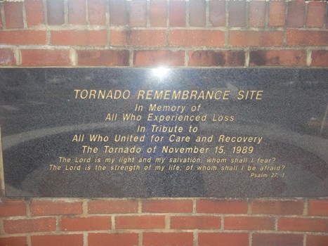
Photo credit: John Hampton


