
 Home/Blog
UPDATE: 7:30 a.m. EST Nov. 18, 2014: Lancaster NY has already received 29 inches, another location southeast of Buffalo is reporting 32 inches on the ground. Thundersnow was reported at Buffalo last night, which is pretty rare for lake effect snow systems.
The severe cold just now entering the northeast U.S. is forecast to cause intense lake effect snow bands to form over Lake Erie and Lake Ontario late tonight through tomorrow night.
Areas impacted will be at the eastern ends of those lakes, mainly over upstate New York between Watertown and Oswego to the lee of Lake Ontario, and mainly south of Buffalo at the east end of Lake Erie.
The latest hi-res model forecast shows the areas of the heaviest snow accumulations, approaching 4 feet by Wednesday (click image for full size):
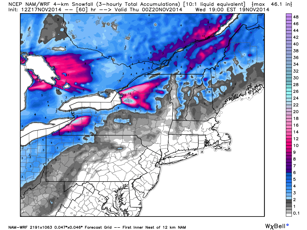
Total snow accumulations forecast by Wednesday evening, Nov. 19, 2014 (graphic courtesy of Weatherbell.com).
These forecast model calculations assume a 10:1 snow:water ratio, but lake effect snow is usually fluffier, leading to deeper snow. So I wouldn’t be surprised to see totals in excess of 4 feet by Wednesday.
Early winter lake effect snowstorms tend to be the heaviest, because the Great Lakes have not had time to cool off yet, and it is the relatively warmer water evaporating into the cold air that causes lake effect snow bands to form.


