Funky Clouds off California Coast Yesterday

February 4th, 2015 by Roy W. Spencer, Ph. D.

Almost every day I check out NASA’s Worldview website to look at global color satellite imagery from the MODIS instruments. I’m usually watching weather systems. If nothing else, the imagery is beautiful.

Yesterday, there were some particularly funky looking marine stratus clouds off the coast of California, generally west and southwest of Los Angeles. There are a couple of ship tracks evident, but I think most of the fractal-esque structure is natural (click image for full-size):

MODIS-Aqua-2-3-2015-CA-marine-stratus

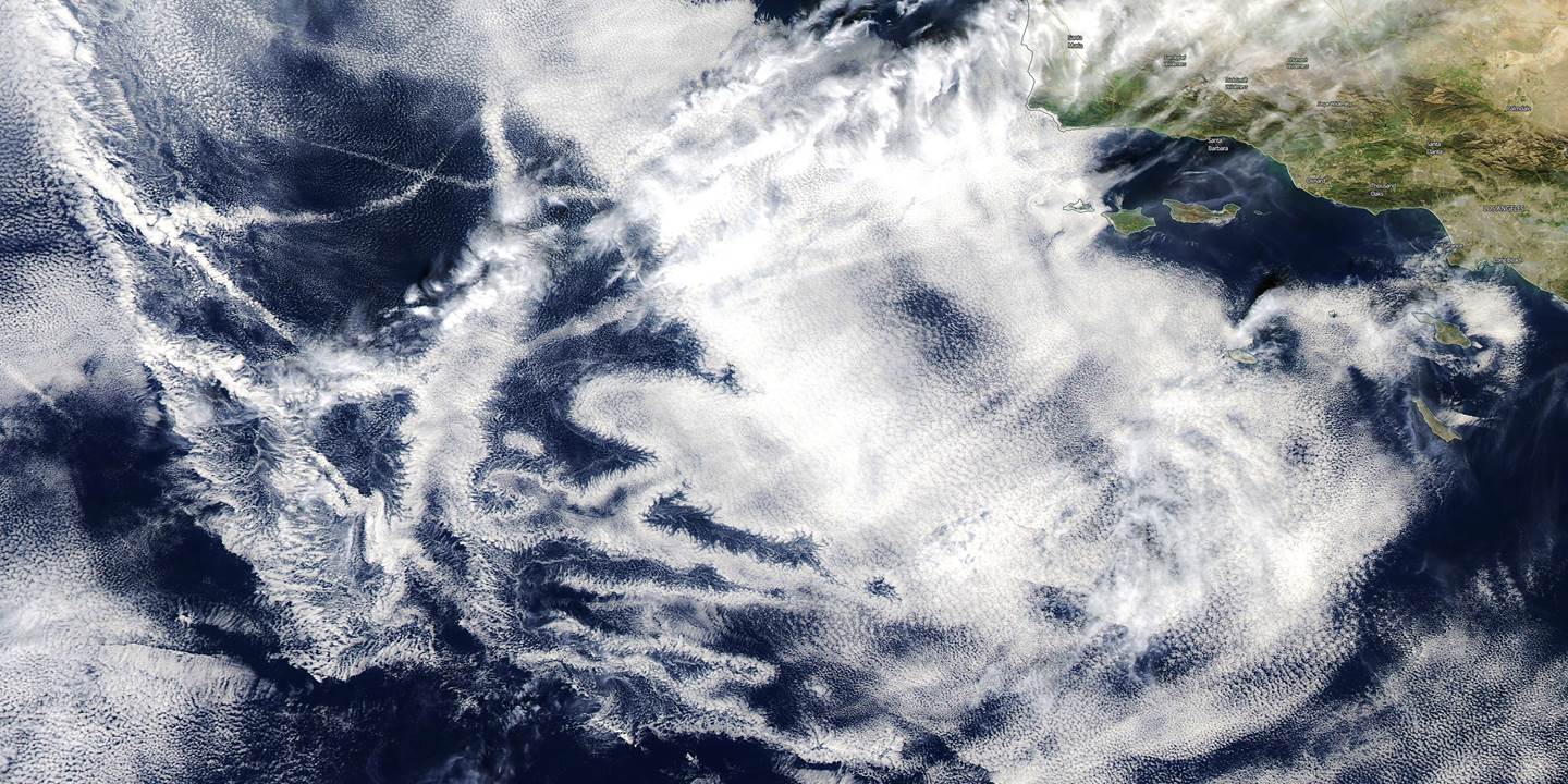
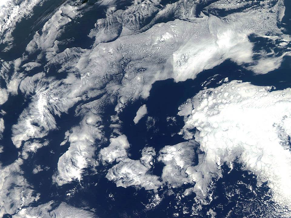
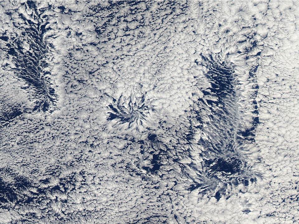
Marine stratus clouds form under a strong temperature inversion at the base of deep sinking air layers associated with high pressure zones, and they take on a wide variety of fascinating forms.

Here’s another example from well off the California coast on Dec. 23, 2014:

MODIS-Aqua-12-23-2014-CA-marine-stratus

And yet another from Dec. 21, 2014:

MODIS-Aqua-12-21-2014-CA-marine-stratus


15 Responses to “Funky Clouds off California Coast Yesterday”

Toggle Trackbacks

  1. RW says:

    Is it known what causes those kinds of clouds? Or clouds that look that way?

    • Roy Spencer says:

      water vapor evaporated from the ocean surface is trapped below the inversion (warm air layer) which prevents convective mixing. The clouds then form just under the inversion where the temperature is the coldest (and so the vapor mixed upward condenses most readily). Infrared radiative processes are also important, as is solar absorption by the clouds. Numerical model simulations of the structure of the clouds have been pretty successful at replicating them.

      • Physics Group says:

        Roy

        “In meteorology, an inversion is a deviation from the normal change of an atmospheric property with altitude. It almost always refers to a “temperature inversion,” [source]

        For example, if the environmental lapse rate is 7C°/Km and the temperature at 1Km is only 3C° colder than the surface, that is an inversion. And that is when entropy increases with downward convective heat transfer until the normal effective “lapse rate” is restored, even if that entails heat transfer from the colder atmosphere into the warmer surface.

        The Clausius “hot to cold” statement is merely a corollary of the Second Law which is subject to the prerequisite that gravitational PE does not change. That is, it only applies in a horizontal plane. The Clausius statement is “proved” from the equations for thermodynamic potentials, but “In thermodynamics, certain forces, such as gravity, are typically disregarded when formulating expressions for potentials.” [source]

  2. boris says:

    “funky clouds” is that a technical description? I enjoy the Dec 23 formation best of the three examples thanks for sharing.

  3. Pathway says:

    Bizzaro world.

  4. Jimw says:

    Aye, very like a whale!

  5. lewis says:

    RE: Dec 23.

    I was on a plane over the SW some time back and saw something similar that went on for 3-500 miles. It looked like cotton candy or cotton balls. Nowhere was there a break. Not at all usual and I was wondering why or how.

    Thank you.

  6. Fulco says:

    It looks like two have a kind of interference pattern.

  7. Bert Walker says:

    I thought it looked like a bunny!

  8. KuhnKat says:

    Obviously gubmint chemtrail effects…

  9. Jimbird says:

    The first image seems to be clearly the clouds formed by jet contrails. Any possibility that is so?

  10. geran says:

    Gosh, all these great cloud formations.

    And, only 11 comments.

    It’s like Doug musta got arrested or somthin….

    (Seriously, Dr. Roy, hope you are watching the snow storms moving NE over Greenland. DMI shows the ice sheet may be making a new 22-year high in the next few weeks. When Greenland loses ice, we are told, sea levels rise. Now that Greenland is gaining ice, do you know which oceans are going dry?)

  11. Physics Group says:

    I’m still awaiting some relevant physics from you geran. The gravito-thermal effect is confirmed with my “experiment” with a Ranque-Hilsch vortex tube in which air follows a helical path and thus encounters a strong centrifugal force. That force has the same effect as gravity in that it redistributes molecule kinetic energy and creates a temperature gradient, just as we find in every planetary troposphere. That’s how the vortex tube delivers hot and cold streams of air.

    This comment is continued here on the website now endorsed by our group. You can read more also on the thread about January temperature data.

  12. geran says:

    One of your problems, Doug, is that you would not know “relevant physics” if the subject fell on your head.

    • PhysicsGroup says:

      When you have something specific to ask about in the website feel free to do so, geran, and I’ll explain the relevance if you still don’t get it. My students will tell you I’m patient and I’ve helped many with physics since my first degree in such in the 1960’s. But then I’d guess most of them would understand the relevance of comparing the effect of force fields, be they centrifugal or gravitational, because they each form density and temperature gradients as entropy approaches the limit – a pretty obvious fact I would suggest because only at maximum entropy does one expect there to be no unbalanced energy potentials. I’m sure if you thought about it, and read what has been explained in our group’s website, it’s probably not out of your depth.

Leave a Reply