
 Home/Blog
Portions of up to ten plains states are covered by smoke this morning from hundreds of wildfires now raging in western Canada.
Unusually dry weather combined with thousands of dry lightning strikes has caused most of the fires, with some evacuations being reported. The firefighting conditions are reported to be particularly dangerous, with shifting winds and dry timber.
Yesterday’s color satellite imagery from NASA’s MODIS imager shows the pale blue smoke, with some darker brown smoke colors nearer the fire sources in Alberta and Saskatchewan:
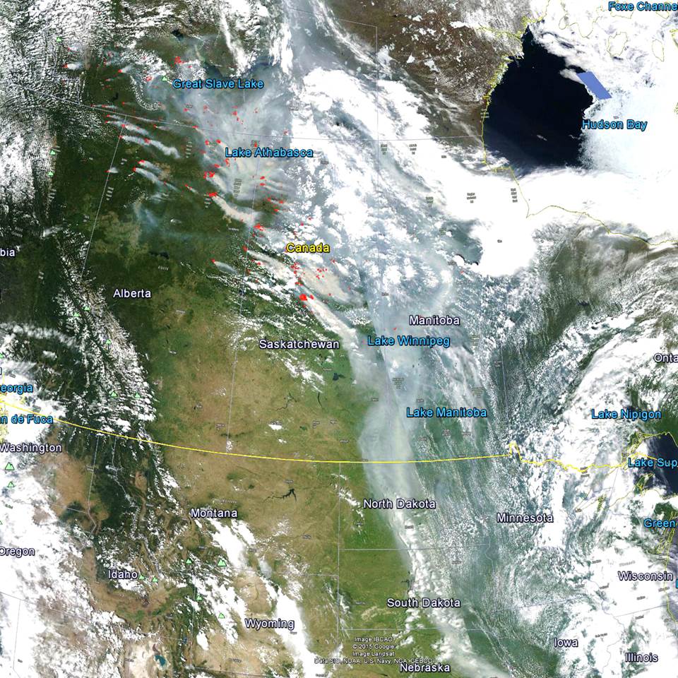
Smoke from Canadian wildfires entering the U.S. on 28 June 2015 (NASA MODIS image remapped into Google Earth).
A close-up view by MODIS reveals just how dirty the smoke is from a couple of the bigger fires in central Saskatchewan (red dots are satellite infrared-diagnosed hotspots):
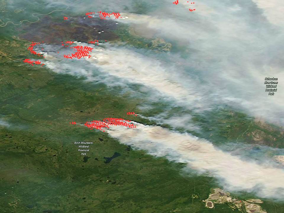
MODIS close-up view of fires in Canada, June 28, 2015.
GOES imagery from this morning shows the smoke now extending into Oklahoma, and the area impacted will expand and drift over the eastern U.S. in the coming days.


