
 Home/Blog
UPDATE: (8:50 a.m. EDT Sunday, Oct. 4). As predicted, heavy rain has spread over much of SC during the night, and there are widespread reports of over 10 inches of total storm rainfall, with one of 24 inches (Mt. Pleasant, near Charleston). Columbia has received 8-10 inches, and heavy rain continues there. Unbelievably, the midnight GFS model run predicts an additional 12 inches of rain over much of central and southeast SC by mid-day Monday. I suspect we are looking at a catastrophic flooding situation in some areas.

The Pacolet River, South Carolina, flood of 1903.
As much as two feet of rain is expected in South Carolina this weekend, which could produce the worst flooding in the state since records began. Governor Nikki Haley has already declared a state of emergency for the state. For comparison, the worst SC floods on record occurred in 1903, 1908, 1940, 1945, and 1990.
Flooding has already begun in Charleston, where 5-7 inches of rain has accumulated as of this morning and some water rescues are being made. North Myrtle Beach has received 9.30 inches so far.
Here is the latest GFS model predicted rain totals by Monday morning (graphic courtesy of Weatherbell.com):
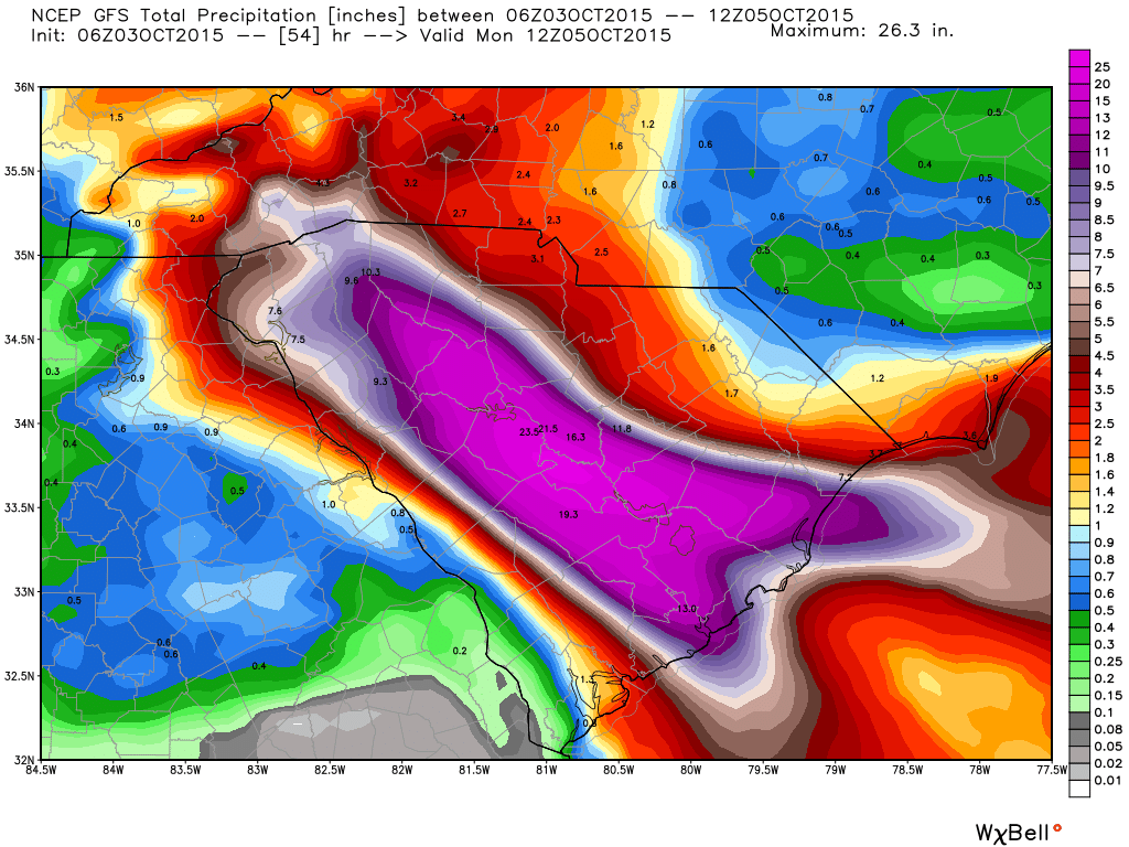
Total predicted rainfall by Monday morning, Oct. 5, from the GFS model.
Purple areas in the above image indicate over 12 inches of predicted rainfall.
So far, most of the rain has been restricted to the eastern half of the state where several inches have fallen, but the heavy rain will spread over the rest of the state today.
Local flood information for the Midlands of South Carolina from WLTX can be found here.


