
 Home/Blog
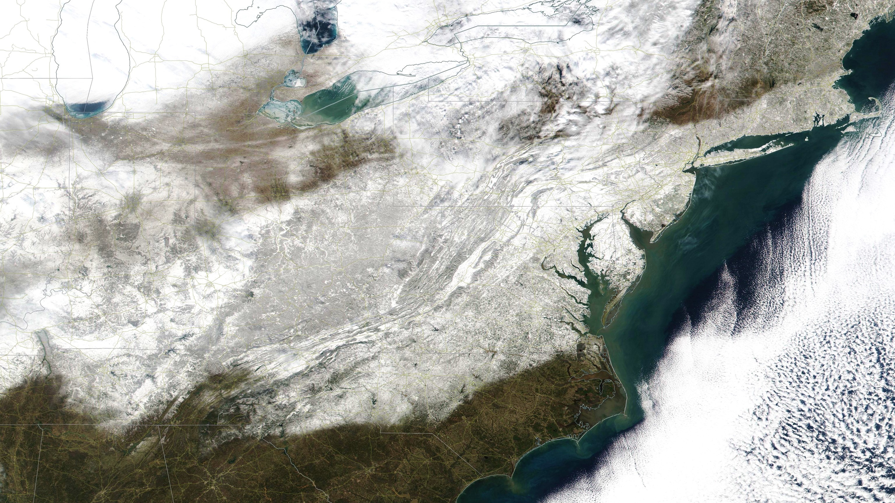
The VIIRS color imager on the Suomi/NPP satellite provided nice views yesterday of the heavy blanket of snow produced by the epic snowstorm of January 22-23, 2016.
Here’s the big picture of the eastern U.S. (click image for the super-sized version, suitable for computer desktop wallpaper):
And here’s a zoomed version covering the area from DC through NYC:
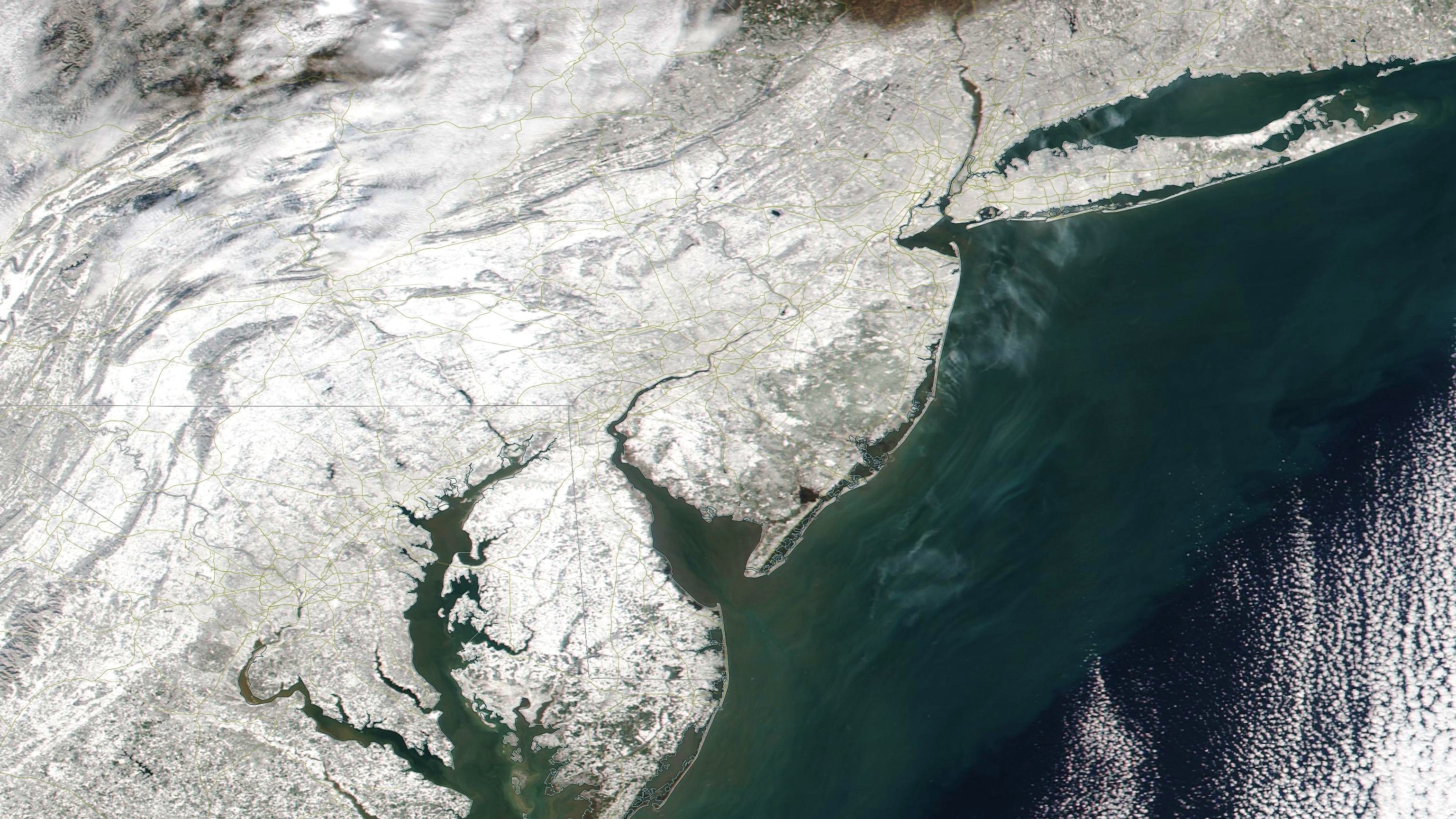
The whitest areas have the least vegetation, usually farm fields.
Enjoy!


