
 Home/Blog
The coast-to-coast cold that will be spreading across the U.S this week will be be accompanied by the development of a Gulf Coast low pressure center that will threaten the South and Southeast with substantial snowfall by the weekend.
The low is just now approaching N. California and will intensify as it travels across the Inter-mountain region, the Texas panhandle, then travel eastward along the Gulf coast by the weekend.
The latest GFS model forecast total snowfall by midday Sunday shows the possibility of 6-12 inch snowfalls across portions of about ten southern states, including Oklahoma, Missouri, Arkansas, Tennessee, Mississippi, Alabama, Georgia, the Carolinas, and Virginia (graphic courtesy of Weatherbell.com):
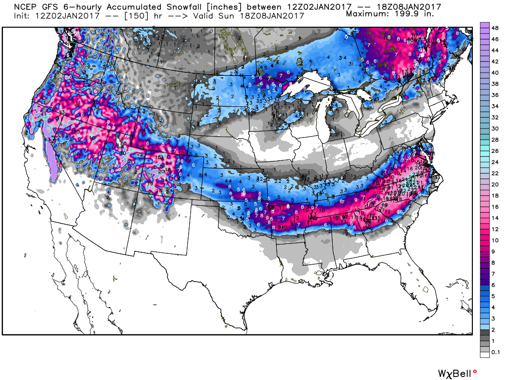
Total snowfall accumulation by midday Sunday, Jan. 8, 2017 as forecast by the NWS GFS forecast model.
It’s still too early to tell what areas will get the greatest snowfall, which in the current forecast approaches two feet in the higher elevations of North Carolina. It’s also possible that a wintry mix including freezing rain will exist along the southern edge of the frozen precipitation region.
UPDATE: As of Tuesday morning (Jan. 3, 2017), the snow path looks like it will be farther south than depicted above, with lesser snow totals: 6-12 inches only over eastern N. Carolina, and up to 3 to 6 inches elsewhere.


