
 Home/Blog
Yesterday, NASA released high-resolution satellite imagery from Landsat, showing the iceberg I’ve dubbed “Icezilla”.
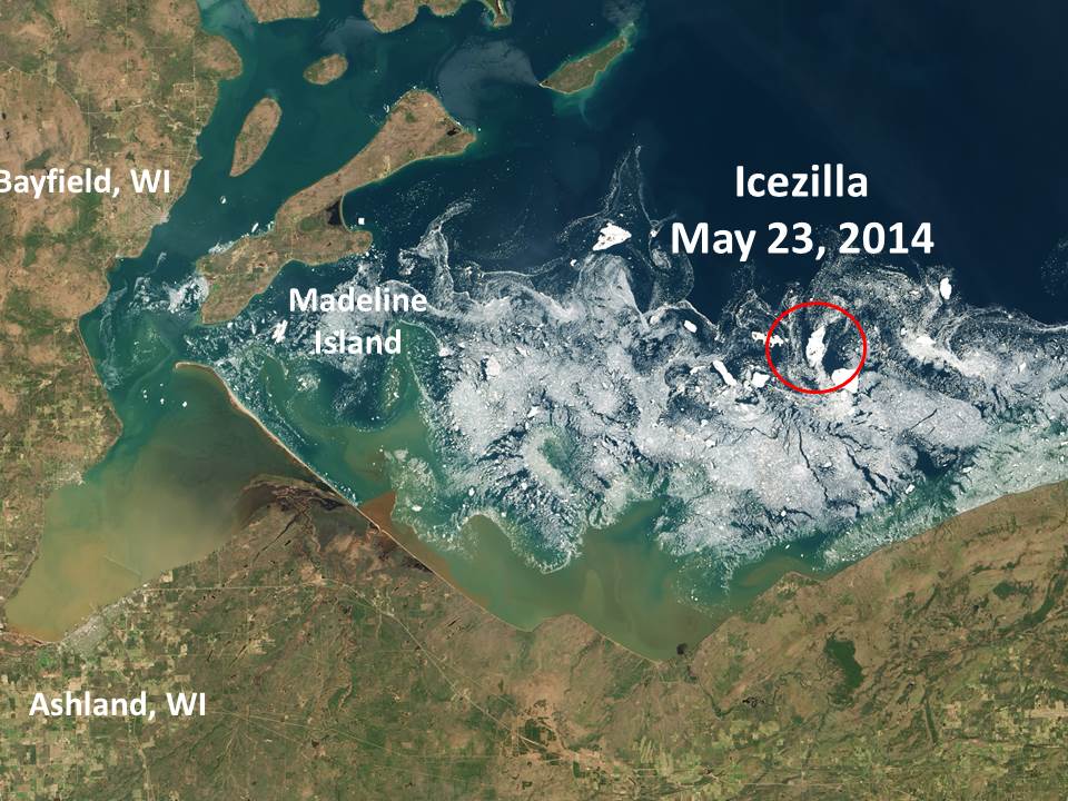
I’ve back tracked through the daily MODIS imagery to find where it originated from, as shown in this Landsat image from May 23 (click for large version):
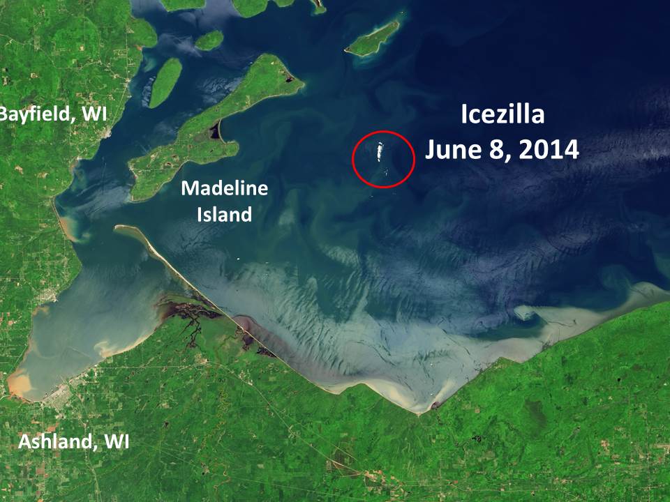
The latest Landsat image provided by NASA is from June 8, at which point the iceberg was about 1 mile long and about 800 ft. wide:
As I mentioned yesterday, this berg is so big that it was spotted from land, 20 miles to the south, on June 10. If it is sufficiently thick, Icezilla could last until July before it fully melts, since water temperatures in the vicinity appear to still be below 40 deg. F.


