Historic Flooding in South Carolina Expected

October 3rd, 2015

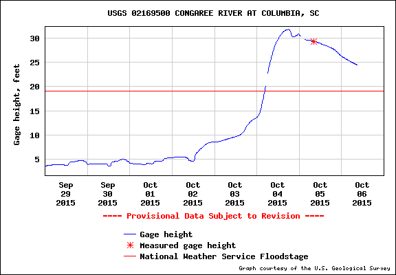
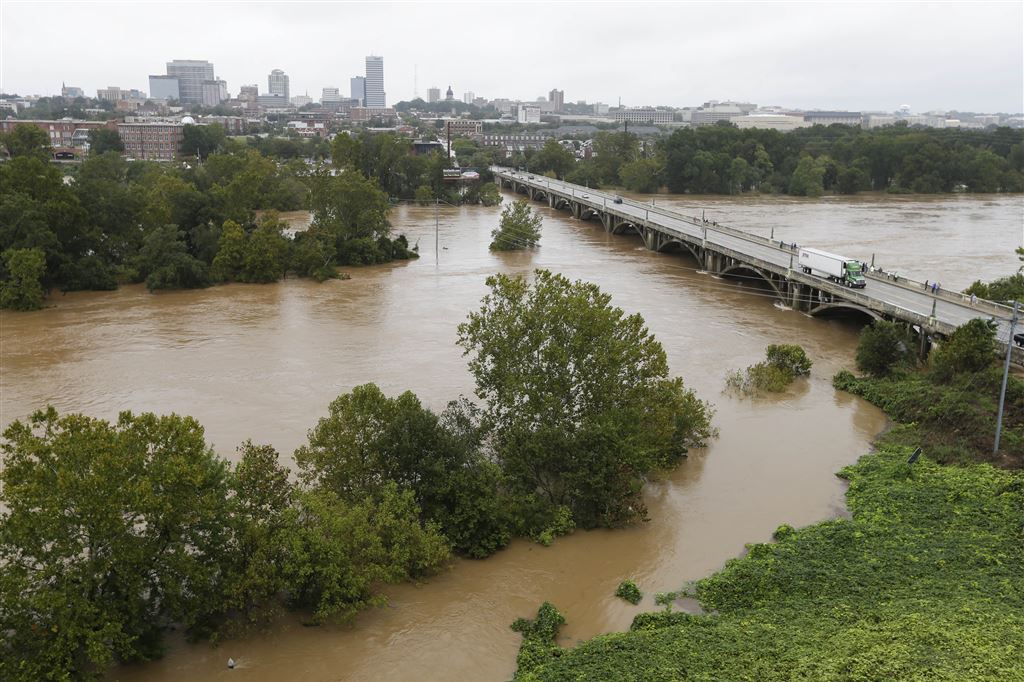
UPDATE: (8:50 a.m. EDT Sunday, Oct. 4). As predicted, heavy rain has spread over much of SC during the night, and there are widespread reports of over 10 inches of total storm rainfall, with one of 24 inches (Mt. Pleasant, near Charleston). Columbia has received 8-10 inches, and heavy rain continues there. Unbelievably, the midnight GFS model run predicts an additional 12 inches of rain over much of central and southeast SC by mid-day Monday. I suspect we are looking at a catastrophic flooding situation in some areas.

The Pacolet River, South Carolina, flood of 1903.

The Pacolet River, South Carolina, flood of 1903.

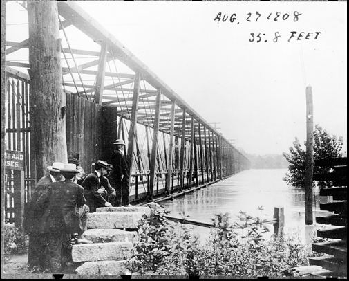
As much as two feet of rain is expected in South Carolina this weekend, which could produce the worst flooding in the state since records began. Governor Nikki Haley has already declared a state of emergency for the state. For comparison, the worst SC floods on record occurred in 1903, 1908, 1940, 1945, and 1990.

Flooding has already begun in Charleston, where 5-7 inches of rain has accumulated as of this morning and some water rescues are being made. North Myrtle Beach has received 9.30 inches so far.

Here is the latest GFS model predicted rain totals by Monday morning (graphic courtesy of Weatherbell.com):

Total predicted rainfall by Monday morning, Oct. 5, from the GFS model.

Total predicted rainfall by Monday morning, Oct. 5, from the GFS model.

Purple areas in the above image indicate over 12 inches of predicted rainfall.

So far, most of the rain has been restricted to the eastern half of the state where several inches have fallen, but the heavy rain will spread over the rest of the state today.

Local flood information for the Midlands of South Carolina from WLTX can be found here.

Current South Carolina radar

UAH V6.0 Global Temperature Update for Sept. 2015: +0.25 deg C

October 2nd, 2015

NOTE: This is the sixth monthly update with our new Version 6.0 dataset. Differences versus the old Version 5.6 dataset are discussed here.

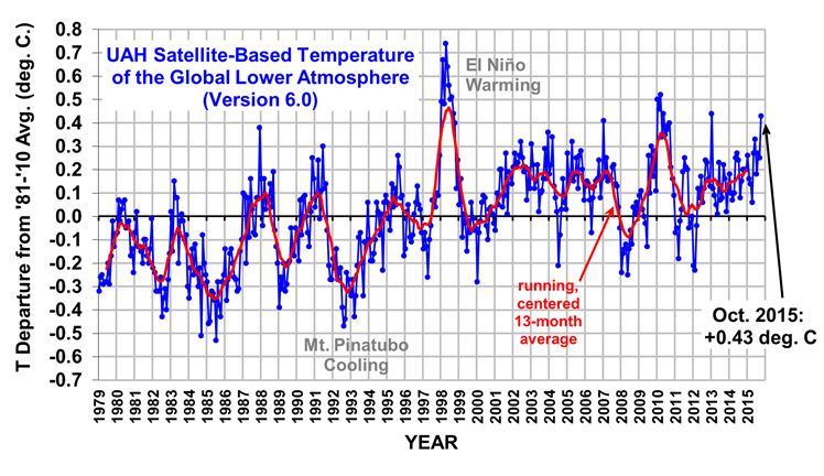
The Version 6.0 global average lower tropospheric temperature (LT) anomaly for September, 2015 is +0.25 deg. C, down slightly from the August, 2015 value of +0.28 deg. C (click for full size version):

UAH_LT_1979_thru_September_2015_v6

The global, hemispheric, and tropical LT anomalies from the 30-year (1981-2010) average for the last 9 months are:

YR MO GLOBE NH SH TROPICS
2015 1 +0.28 +0.40 +0.16 +0.13
2015 2 +0.18 +0.30 +0.05 -0.06
2015 3 +0.17 +0.26 +0.07 +0.05
2015 4 +0.09 +0.18 -0.01 +0.10
2015 5 +0.29 +0.36 +0.21 +0.28
2015 6 +0.33 +0.41 +0.25 +0.46
2015 7 +0.18 +0.33 +0.03 +0.48
2015 8 +0.28 +0.25 +0.30 +0.52
2015 9 +0.25 +0.14 +0.17 +0.55

The tropics continue to slowly warm with El Nino conditions there.

The global image for September, 2015 should be available in the next several days here.

The new Version 6 files (use the ones labeled “beta3”) should be updated soon, and are located here:

Lower Troposphere: http://vortex.nsstc.uah.edu/data/msu/v6.0beta/tlt
Mid-Troposphere: http://vortex.nsstc.uah.edu/data/msu/v6.0beta/tmt
Tropopause: http://vortex.nsstc.uah.edu/data/msu/v6.0beta/ttp
Lower Stratosphere: http://vortex.nsstc.uah.edu/data/msu/v6.0beta/tls

Hurricane Joaquin: False Alarm for the U.S. East Coast?

October 1st, 2015

The GFS model runs from last night and this morning have shifted the track of Hurricane Joaquin significantly eastward, reducing the possibility of a direct hit on the U.S.

The National Hurricane Center has conservatively adjusted it’s official forecast track a little to the east, but their storm discussion drops an important hint:

“It is also possible that Joaquin will remain far from the U.S. east coast.”

Here’s the latest official forecast track:

Joaquin-145823W5_NL_sm

Yet, the very latest GFS model run just in has shifted the storm even farther east, so I suspect we will see the official forecast follow suit this afternoon. Here’s the latest GFS forecast position for 2 p.m. Monday afternoon (graphic courtesy of Weatherbell.com):

GFS model forecast sea level pressure and near-surface winds for 2 p.m. Monday, October 5, 2015.

GFS model forecast sea level pressure and near-surface winds for 2 p.m. Monday, October 5, 2015.

If that forecast is anywhere close to correct, even Nova Scotia will be spared.

Nevertheless, heavy rains are forecast to continue for the mid-Atlantic states, with excessively large amounts possible in portions of the Carolinas. The latest model run indicates as much as 12-18 inches in South Carolina (!)

None of this is a done deal, however. The longer Joaquin lingers in the Bahamas, the farther east it will likely track as the approaching trough from the west picks it up. But if it decides to head north a little early, it could still hit as far south as the Carolinas. So, the forecast remains unusually risky at this point, and the NHC (and the NWS in general) must always err on the side of caution.

What I find a little ironic is that if this storm were to hit the East Coast, we would have to suffer through endless claims of “climate change!”. Yet if it stays at sea, no one complains.

It’s the same storm, folks, no matter what track it takes.

Hurricane Joaquin: “Established by God”

September 30th, 2015
Hurricane Joaquin as imaged by the NASA MODIS instrument mid-day Wednesday, Sept. 30, 2015 (Google Earth remap).

Hurricane Joaquin as imaged by the NASA MODIS instrument mid-day Wednesday, Sept. 30, 2015 (Google Earth remap).

After ten years without a major (Cat3+) hurricane hit on the U.S., intensifying Hurricane Joaquin (from the Hebrew for “established by Jehovah”) is causing understandable nervousness along the East Coast.

The storm is still meandering east of the Bahamas, and there is great uncertainty about just when it will be picked up by an approaching trough from the west. The National Hurricane Center is calling for it to reach “major hurricane” status, but as can be seen in the following graphic, the model guidance is all over the map regarding the track:

Joaquin-11L_tracks_latest

We will know more in the next day or two, but one very real possibility is that the hurricane will join forces with the weather system approaching from the west, and cause some pretty nasty flooding from the Carolinas up through the mid-Atlantic, along with widespread high winds.

Nothing is for sure right now, so stay tuned.

Minnesota Hearing Addresses the Social Cost of Carbon

September 30th, 2015

Estimated changes in vegetative cover due to CO2 fertilization between 1982 and 2010 (Donohue et al., 2013 GRL).

Estimated changes in vegetative cover due to CO2 fertilization between 1982 and 2010 (Donohue et al., 2013 GRL).

I testified before an administrative law judge (ALJ) in St. Paul, MN last week as part of a process that will determine what value the State of Minnesota decides to place on “carbon pollution”, also called the social cost of carbon (SCC).

This was the first expert testimony I have provided other than the several times I have testified in Congress. Congressional testimony is much more free-wheeling…more like a show for entertainment value and political posturing.

The Minnesota hearing was more like what you have seen on TV, with objections being made, sustained, and overruled. There were even accusations of “badgering the witness”.

It was interesting, to say the least.

There were economists who testified on both sides as to whether the economic models used were appropriate, whether they made valid assumptions, etc. I only saw two witnesses testify on that issue, one from each side.

It was clear that the lawyers from both sides were more comfortable cross-examining witnesses on economic issues than on the science behind the IPCC’s estimates of future warming, which (of course) are one of the primary inputs to any SCC model calculation. The greater the human-caused climate change, presumably the greater the damage caused by it (although one can also claim there are benefits, since cold weather kills more people on average than hot weather).

The judge had another judge present to help her out, one with an economics background and who could advise the ALJ on some of the more technical issues. The ALJ seemed most focused on procedural issues (as she should be, I suppose), making decisions regarding whether certain pieces of evidence would be admitted, etc. She seemed fair in the way she handled objections from both sides.

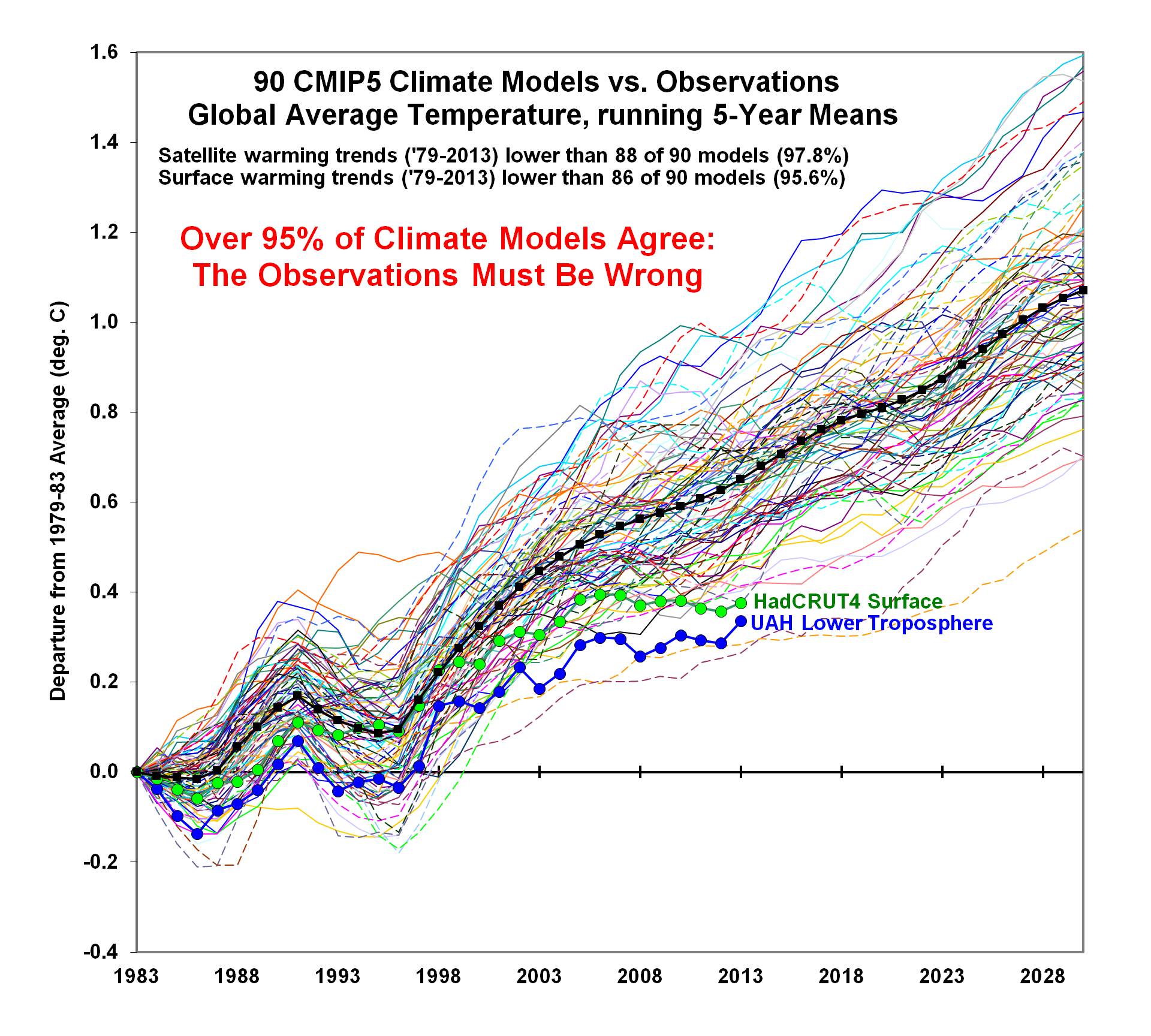
Scientists providing 5-minute opening statements along with me were Dick Lindzen and Will Happer. Lindzen mainly addressed climate sensitivity, Happer argued that CO2 emissions were actually a benefit, and I emphasized that the IPCC models used for the SCC calculations were demonstrably biased in their global warming projections.

As I recall, Happer received a minor question on cross-examination, while Lindzen was pressed on one of his claims regarding climate sensitivity, which he was forced to clarify. All five lawyers declined to ask me any questions on cross examination.

All of us provided written testimony well in advance of the hearing, which was responded to with rebuttal testimony from Andy Dessler and John Abraham. We also provided written rebuttal testimony in response toDessler’s and Abraham’s original written testimony. Another round of surrebuttal testimony then ensued. I believe that Dessler and Abraham provided opening statements this week, but I haven’t heard how that went.

Minnesota state law apparently requires there to be a social cost of carbon assigned to energy production in the state. I suppose that, theoretically, the assigned value could be zero. The question for the judge to address now is whether to replace the current value(s) [which are claimed by environmentalists to be too low] with the federal value, which is much higher, or whether it should be recalculated from scratch. Some good background on this can be found in a news story here from a year ago.

No matter which way the judge rules, I hear the ruling will likely be appealed. Then, no matter what the final ruling is, the Minnesota Public Utilities Commission can probably just do what they want to do, anyway. I believe that the Commission simply asked the judge to help them with the process. I will admit that legal issues sometimes confuse me, so people are free to correct me on any of this I got wrong.

I suspect we are going to see more state-level challenges to the “social cost of carbon”, which is basically addressing the unintended “negative externality” consequences of our use of carbon-based fuels. My opinion is that there has been no demonstrated damage caused by adding 1 carbon dioxide molecule to 10,000 molecules of air over the last 100 years. Even the IPCC admits the evidence for increased severe weather is shaky, at best. Whether sea level rise is greater than it was before CO2 emissions could contribute is also debatable.

We do, however, have evidence that increased CO2 boosts crop production and has led to global greening, a positive externality. So, I have to wonder whether the social cost of carbon is actually negative.

My suspicion is that we are in for years of debate and legal challenges on this issue. It seems like the social cost of carbon is an unusual case for the environmentalists to make, when the supposed damages caused by CO2 emissions are not really demonstrable, and future damages are largely theoretical.

S. Fred Singer: A 1960s Trailblazer for Satellite Remote Sensing

September 19th, 2015

fred-singer_0Those of you who follow our efforts to bring some balance to offset global warming alarmism also likely know of our honorary godfather, Fred Singer. Fred has been a tireless crusader, including helping to establish the NIPCC as an answer to the U.N.’s IPCC.

But people like Fred (and myself) didn’t start out in global warming, which is a relatively modern invention. For example, my original claim to fame was developing methods for measuring global precipitation from satellite-borne microwave radiometers, starting in the early 1980s. Fred started out well before me in satellite remote sensing, serving as the first director of the National Weather Satellite Service during 1962-64. I was still in elementary school at that time.

Now, as my 60th birthday approaches in December, I find myself going through my old files and throwing away everything except items of historical interest. Yesterday, I hit upon a stack of old microwave rainfall retrieval papers, and I stumbled upon one I had totally forgot about.

It turns out that Fred Singer wrote one of the very first papers on the possibility of measuring precipitation from satellites with microwave radiometers. The original idea was put forth in brief qualitative terms in a German article authored by Konrad Buettner in 1963. Then, in 1968, Fred and co-author G. F. Williams, Jr., put some theoretical equations and aircraft test flights behind the idea. The article was Microwave Detection of Precipitation over the Surface of the Ocean, in the May 1968 issue of Journal of Geophysical Research.

As an expert in this field, I can tell you that Fred’s treatment of the issue was surprisingly sound and insightful for such an early piece of work. It postulated effects which we now have widespread support for from satellite measurements.

I just wanted to bring attention to his early pioneering work in satellite microwave remote sensing, which eventually led to a wide variety of passive microwave imagers flying in space: ESMR, SMMR, SSM/I, TRMM, SSMIS, AMSR, GMI, and others. I’m sure there are other satellite areas he also helped to pioneer, too.

Great work, Fred!

Satellite Reveals Biblical Mideast Duststorm

September 8th, 2015

The dust storm currently impacting the Middle East started over northern Syria two days ago, and has spread south and westward. I don’t recall one this extensive in this area during the modern satellite era.

The following color imagery from the NASA MODIS instrument reveals the daily progression of the storm, and just how large an area the storm has covered, from southern Turkey to northern Egypt (click to enlarge).

MODIS-Mideast-duststorm

UAH V6.0 Global Temperature Update for Aug. 2015: +0.28 C

September 3rd, 2015

NOTE: This is the fifth monthly update with our new Version 6.0 dataset. Differences versus the old Version 5.6 dataset are discussed here.

The Version 6.0 global average lower tropospheric temperature (LT) anomaly for August, 2015 is +0.28 deg. C, up from the July, 2015 value of +0.18 deg. C (click for full size version):
UAH_LT_1979_thru_August_2015_v6

The global, hemispheric, and tropical LT anomalies from the 30-year (1981-2010) average for the last 8 months are:

YR MO GLOBE NH SH TROPICS
2015 1 +0.28 +0.40 +0.16 +0.13
2015 2 +0.18 +0.30 +0.05 -0.06
2015 3 +0.17 +0.26 +0.07 +0.05
2015 4 +0.09 +0.18 -0.01 +0.10
2015 5 +0.29 +0.36 +0.21 +0.28
2015 6 +0.33 +0.41 +0.25 +0.46
2015 7 +0.18 +0.33 +0.03 +0.48
2015 8 +0.28 +0.25 +0.30 +0.52

The tropics continue warm with El Nino conditions there.

The global image for August, 2015 should be available in the next several days here.

The new Version 6 files (use the ones labeled “beta3”) should be updated soon, and are located here:

Lower Troposphere: http://vortex.nsstc.uah.edu/data/msu/v6.0beta/tlt
Mid-Troposphere: http://vortex.nsstc.uah.edu/data/msu/v6.0beta/tmt
Tropopause: http://vortex.nsstc.uah.edu/data/msu/v6.0beta/ttp
Lower Stratosphere: http://vortex.nsstc.uah.edu/data/msu/v6.0beta/tls

Hurricane Fred a New Record: Farthest East

August 31st, 2015

Newly formed Hurricane Fred over the Cape Verde Islands is, as far as I can tell, the farthest east that a hurricane has formed in the Atlantic, based upon modern historical records. It appears to be only the third hurricane to directly impact the Islands.

This color satellite view from the NASA MODIS imager shows an event we might not see again in our lifetimes (click for full size):

Hurricane Fred over the Cape Verde Islands, 31 August 2015.

Hurricane Fred over the Cape Verde Islands, 31 August 2015.

Fred is traveling northwestward and is not expected to impact North America, and should slowly weaken in the next few days as it encounters colder waters.

Summer Snow to Greet Obama on Alaska Climate Trip

August 30th, 2015

When President Obama visits Alaska this week to campaign for a new international agreement to fight global warming climate change, Alaska will be experiencing colder than normal weather and forecast summer snows, as seen in this WeatherBell.com graphic of forecast total snowfall by Friday:

Forecast total snowfall by Friday, Sept. 4, 2015 from the GFS model (WeatherBell.com graphic).

Forecast total snowfall by Friday, Sept. 4, 2015 from the GFS model (WeatherBell.com graphic).

Besides this latest example of the Gore Effect, the dirty little secret is that the climate is always changing, and what better place to illustrate the role of Mother Nature (not humans) than in Alaska?

Extreme Weather
Alaska weather matches its geography – extreme. Temperatures there have ranged from 100 deg F (in 1915) to 80 below zero F (in 1971). Summer days are so long that they can grow pumpkins weighing over 1,000 lbs. Nevertheless, yearly average temperatures are actually below freezing — even in the warmest years.

Glaciers were Already Retreating Before 1900
The supposed poster child glacier for global warming in Alaska is Mendenhall Glacier…except that it had already retreated one mile by the early 1900s, long before human greenhouse gas emissions could be blamed.

Furthermore, its retreat is uncovering large tree stumps approximately 1,000 years old, coincidentally coinciding with the (naturally-caused) Medieval Warm Period, back when the Vikings were able to farm in Greenland.

Which begs the question: How could it have been warm enough to grow giant trees 1,000 years ago in an area now covered in ice? We don’t know why it was so warm 1,000 years ago—climate scientists don’t like to talk about it because they can’t explain it — but for some reason they are sure that your SUV is causing current warmth.

Alaska’s Recent Warmth is Mostly Due to the Pacific Decadal Oscillation
NOAA’s official average temperature product for Alaska, even after they’ve made innumerable and controversial adjustments, shows cooling from the 1920s to the late 1970s, then sudden warming associated with the Great Climate Shift of 1977:

NOAA official Alaska average annual temperatures, (Aug. to July) through July 2015 (NCDC Climate at a Glance).

NOAA official Alaska average annual temperatures, (Aug. to July) through July 2015 (NCDC Climate at a Glance).

This shift was due to a natural reversal of the Pacific Decadal Oscillation, a 60 year cycle which affects the atmospheric steering currents in Alaska, determining whether cold polar air or warm Pacific air tends to win out as the two air masses continually battle for control over Alaska weather.

Alaskans are used to tremendous extremes in weather throughout the year. The tree stump evidence by itself suggests it was warmer there 1,000 years ago than today.

Yet, President Obama will no doubt wax eloquent about how all weather and glacier changes in Alaska (1) have been brought on by humans, and (2) are bad. I’m sure this is what’s taught in schools now, and many will believe it.

But don’t you believe it.