
 Home/Blog
Our satellite passive microwave radiometer assets have really advanced since the launch of the first Special Sensor Microwave/Imager (SSM/I) in 1987. The SSM/I and SSMIS have been providing global oceanic measurements of surface wind speed, total atmospheric water vapor, total cloud water, and rain rates, since mid-1987.
Frank Wentz and his homies at Remote Sensing Systems have produced intercalibrated ocean products from these sensors and post those products (in binary form, not for the weak of heart) at their ftp server. I’ve downloaded the archive of weekly averages from the separate satellites (you can also get daily and monthly), combined the separate satellites when more than one is operating, and computed weekly anomalies.
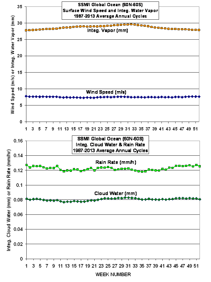
Here are the average annual cycles for the 4 products. Note there is little seasonal variations when the oceans are globally averaged:
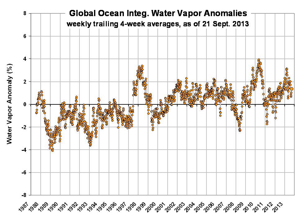
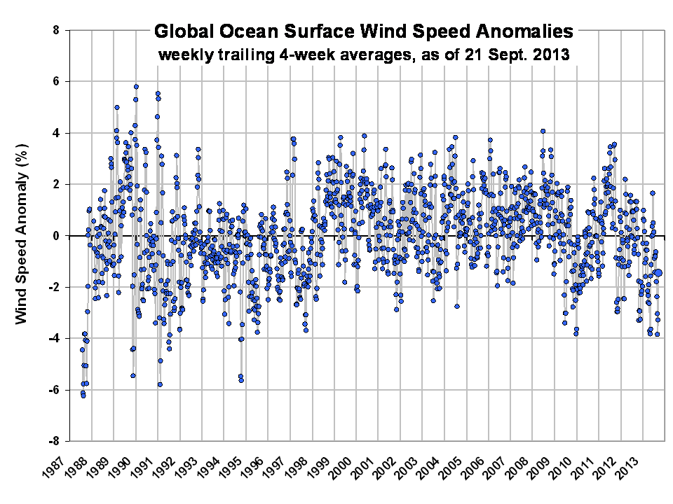
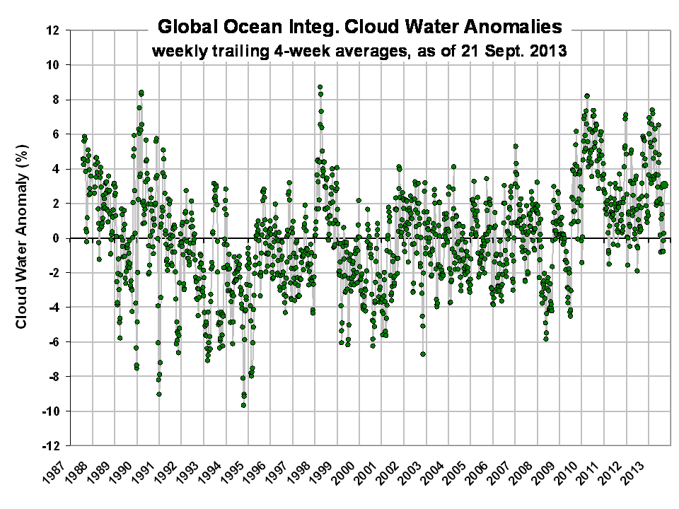
Next are the global anomaly time series since July 1987 (departures from the 27-year average weekly cycle, in percent) through Saturday, September 21, 2013.
WATER VAPOR: The vertically-integrated water vapor variations follow sea surface temperature variations rather closely, including moistening during El Nino and drying during La Nina, and support other datasets showing warming until the 1998-2002 time period, then leveling off:
WIND SPEED: Wind speeds tend to decrease during El Nino events and increase during La Nina. I’ll leave it to you to determine whether there has been a recent increase in wind speed which might support Trenberth’s view that increased surface winds have increased ocean mixing and thereby increased the rate of heat storage in the deep ocean:
CLOUD WATER:Cloud water tends to increase during El Nino and decrease during La Nina. Also, I’ve previously found from AMSR-E cloud water retrievals that these anomalies correlate positively with CERES reflected sunlight anomalies, so positive values should suggest a cooling influence compared to average:
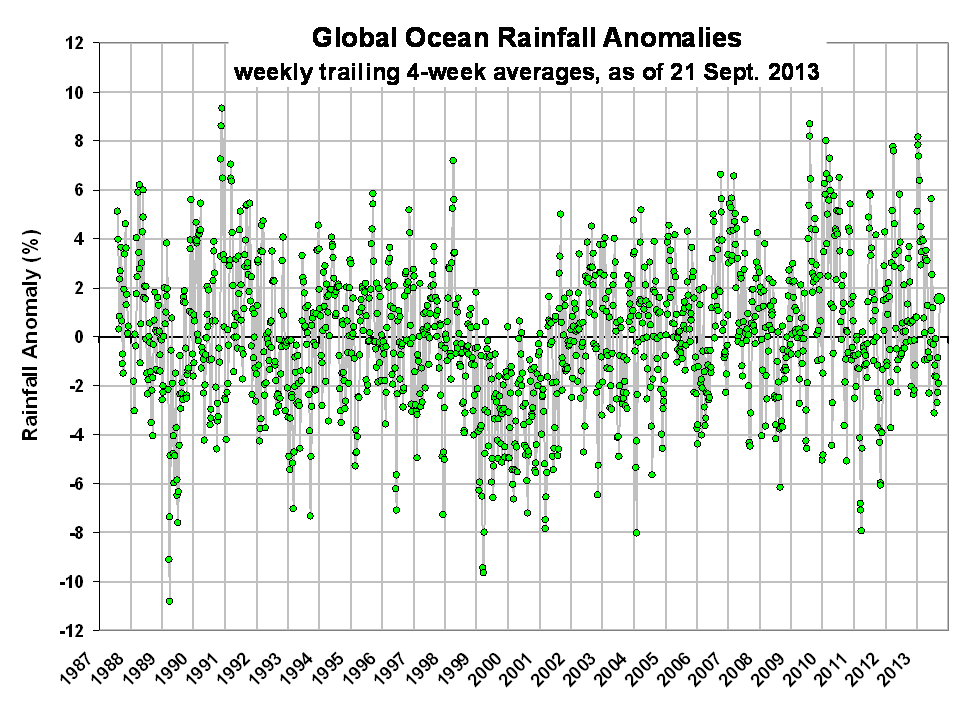
RAIN RATE:Like water vapor and cloud water, the rain rate anomalies tend to be higher during El Nino and lower during La Nina.
The largest and most coherent anomaly patterns will show up during El Nino or La Nina, but right now we are in neutral conditions, so not much is happening. If there is sufficient interest I can provide weekly updates of these plots every week or two (if I’m in town) up through the previous Saturday.
Here’s an Excel spreadsheet with the anomaly time series data from the above 4 plots…please don’t download unless you plan on doing something with the data: SSMI_weekly_global_anoms_60N-60S_percent.
Here are high spatial resolution product examples for the global oceans from today (morning passes from the DMSP F17 satellite SSMIS).


